- Usage in publication:
-
- Whiskey Butte Bed
- Modifications:
-
- Named
- Dominant lithology:
-
- Siltstone
- Mudstone
- Claystone
- Marlstone
- AAPG geologic province:
-
- Green River basin
Summary:
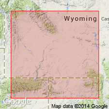
Named as a bed of Bridger Formation for Whiskey Butte 7 1/2 min quad and a locality [not specified] in T21N, R111W, Lincoln Co, WY, Greater Green River basin. No type locality designated. Was formerly termed lower Bridger A by some. Attains maximum thickness of 230 ft along Hams Fork near Opal, Lincoln Co. Composed of light-gray or greenish siltstone, mudstone, and claystone. Coarser units increase upwards. Contains volcanic debris reworked by streams and highly weathered. Well rounded cobbles of andesite in channel sandstones at many levels in the Whiskey Butte. The channel sandstones are fine to coarse grained, poorly sorted and have varying amounts of silt and clay. Conglomeratic layers of clay and mud balls in a sandy matrix are common. Sand is quartz and subhedral feldspar with nonopaque heavy minerals (biotite, augite, amphibole, epidote). Cemented with calcite. Sheet sandstones are thinner and grade into siltstone and mudstone. Probable source of volcanics would be the Absaroka Range. Thin layers of marlstone, ostracodal or algal limestone occur at many levels in the bed. Intertongues with Laney Member of Green River Formation, lying between the newly named Craven Creek (below) and Cow Hollow (above) Beds of the Laney. Is of Eocene age. Geologic map. Cross sections.
Source: GNU records (USGS DDS-6; Denver GNULEX).
For more information, please contact Nancy Stamm, Geologic Names Committee Secretary.
Asterisk (*) indicates published by U.S. Geological Survey authors.
"No current usage" (†) implies that a name has been abandoned or has fallen into disuse. Former usage and, if known, replacement name given in parentheses ( ).
Slash (/) indicates name conflicts with nomenclatural guidelines (CSN, 1933; ACSN, 1961, 1970; NACSN, 1983, 2005, 2021). May be explained within brackets ([ ]).

