- Usage in publication:
-
- Wheeler formation*
- Modifications:
-
- Named
- Dominant lithology:
-
- Limestone
- Shale
- AAPG geologic province:
-
- Great Basin province
Summary:
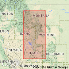
Named for exposures (also the type locality) in the center of Wheeler Amphitheater, southeast of Antelope Springs, House Range, Millard Co, UT in the Great Basin province. Is composed of alternating bands of thin shaly limestone and calcareous shale 570 ft thick. Overlies Swasey formation (new); underlies Marjum formation (new). Contains a Middle Cambrian fauna.
Source: GNU records (USGS DDS-6; Denver GNULEX).

- Usage in publication:
-
- Wheeler shale
- Modifications:
-
- Overview
- Dominant lithology:
-
- Shale
- Limestone
- AAPG geologic province:
-
- Great Basin province
Summary:
Type locality emended as measured in vicinity of Marjum Canyon in the House Range, western UT in the Great Basin province. Diagram shows comparison of boundaries used by Walcott with those assigned to Wheeler in this report. Walcott's Wheeler shale was 570 ft thick. Wheeler in this report is 350 ft thick. Overlies Dome limestone. Underlies Swasey limestone. Contains numerous fossils--trilobites. Consists of sooty, black (pale gray weathering), fine-grained, platy, calcareous shale and numerous intercalated argillaceous and arenaceous limestones. Is poorly exposed in the House Range. Forms buff-gray slopes wherever it occurs. Middle Cambrian age.
Source: GNU records (USGS DDS-6; Denver GNULEX).
For more information, please contact Nancy Stamm, Geologic Names Committee Secretary.
Asterisk (*) indicates published by U.S. Geological Survey authors.
"No current usage" (†) implies that a name has been abandoned or has fallen into disuse. Former usage and, if known, replacement name given in parentheses ( ).
Slash (/) indicates name conflicts with nomenclatural guidelines (CSN, 1933; ACSN, 1961, 1970; NACSN, 1983, 2005, 2021). May be explained within brackets ([ ]).

