The National Geologic Map Database is migrating to a new infrastructure. We apologize for any service disruptions during this process.
|
|---|


- Usage in publication:
-
- Wewoka formation*
- Modifications:
-
- Named
- Dominant lithology:
-
- Sandstone
- Shale
- Conglomerate
- Limestone
- AAPG geologic province:
-
- Arkoma basin
- Chautauqua platform
Summary:
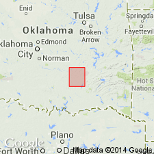
Named from town of Wewoka, Seminole Co, OK; no type locality designated. Area of report is Coalgate quad, Coal and Hughes Cos, OK, Arkoma basin and Chautauqua platform. Overlies Wetumka shale (new); underlies Holdenville shale (new). Is a succession of massive, mostly friable sandstones and shales--7 alternating beds in all--from 40 to 130 ft thick; total thickness of formation 700 ft. Separate beds are thick enough to be mapped; not done because of obscurity of contacts and friable nature of unit. Consists of (ascending): 1) sandstone division, which is thinner, but generally harder, than succeeding 3 sandstone divisions. At base of this division are local indurated beds of sandy chert conglomerate, which thin east and north; outcrop hardly perceptible on border of Canadian River Valley. 2) Next is fossiliferous, friable blue clay shale 120 ft thick, ending locally in thin, white, fossiliferous limestone. 3) Succeeding sandstone member is about 110 ft thick; beds are massive and friable, breaking down into loose sand and weathering into rounded ledges. 4) Next is soft, fossiliferous blue clay shale nearly 130 ft thick; remarkable for abundant, perfectly preserved fossil shells. 5) Next is 60-ft-thick sandstone bed. 6) Next is a 45-ft shale bed. 7) At top is sandstone member estimated 100 ft thick. Uppermost beds of this topmost member are shaly, and culminate in a shaly sandy limestone. Carboniferous. Geologic map.
Source: GNU records (USGS DDS-6; Denver GNULEX).
For more information, please contact Nancy Stamm, Geologic Names Committee Secretary.
Asterisk (*) indicates published by U.S. Geological Survey authors.
"No current usage" (†) implies that a name has been abandoned or has fallen into disuse. Former usage and, if known, replacement name given in parentheses ( ).
Slash (/) indicates name conflicts with nomenclatural guidelines (CSN, 1933; ACSN, 1961, 1970; NACSN, 1983, 2005, 2021). May be explained within brackets ([ ]).