


- Usage in publication:
-
- Westfield shale
- Modifications:
-
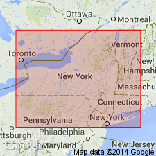
- Areal extent
- AAPG geologic province:
-
- Appalachian basin
Summary:
Pg. 69. [Westfield shale applied in table to beds of Chemung age overlying Laona sandstone and underlying Shumla sandstone in Chautauqua County, western New York.]
Source: US geologic names lexicon (USGS Bull. 896, p. 2307).
- Usage in publication:
-
- Westfield shale
- Modifications:
-
- Areal extent
- Dominant lithology:
-
- Shale
- AAPG geologic province:
-
- Appalachian basin
Summary:
Pg. 151. For the beds between Laona [below] and Shumla sandstones the name Westfield shale may be used. Lithologically indistinguishable from Gowanda beds, they contain, like those at west, a persistent Portage cephalopod element in their fauna, yielding eastward wholly to Chemung brachiopods. East of Cattaraugus these beds appear to maintain their identity as far as Elton, beyond where they are gradually merged in [lower part of] Wellsburg [sandstone] member. Thickness 120 feet on Lake Erie, 160 feet at Laona, and perhaps 200 feet near Perrysburg. [Age is Late Devonian.]
[Probably named from exposures at or near Westfield, Chautauqua Co., western NY.]
Source: US geologic names lexicon (USGS Bull. 896, p. 2307).

- Usage in publication:
-
- Westfield shale
- Modifications:
-
- Revised
- AAPG geologic province:
-
- Appalachian basin
Summary:
Pg. 369. Included all above-mentioned beds in the Chemung, but G.H. Chadwick (1933, etc.) transferred them all to his Canadaway group.
Source: US geologic names lexicon (USGS Bull. 896, p. 2307).
For more information, please contact Nancy Stamm, Geologic Names Committee Secretary.
Asterisk (*) indicates published by U.S. Geological Survey authors.
"No current usage" (†) implies that a name has been abandoned or has fallen into disuse. Former usage and, if known, replacement name given in parentheses ( ).
Slash (/) indicates name conflicts with nomenclatural guidelines (CSN, 1933; ACSN, 1961, 1970; NACSN, 1983, 2005, 2021). May be explained within brackets ([ ]).