The National Geologic Map Database is migrating to a new infrastructure. We apologize for any service disruptions during this process.
|
|---|


- Usage in publication:
-
- Westboro Formation*
- Modifications:
-
- Age modified
- AAPG geologic province:
-
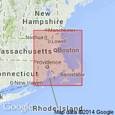
- New England province
Summary:
Assigned a Proterozoic Z age because it is intruded by Proterozoic Z granitoid rocks of Rhode Island batholith. Similar to Plainfield Formation of CT and southern RI in composition and stratigraphic-structural position. Both formations correlate with part or all of Blackstone Group.
Source: GNU records (USGS DDS-6; Reston GNULEX).

- Usage in publication:
-
- Westboro Formation*
- Modifications:
-
- Overview
- AAPG geologic province:
-
- New England province
Summary:
Used as Westboro Formation of Proterozoic Z age. Consists of quartzite, schist, calc-silicate quartzite, and amphibolite. In Saugus and Lynnfield areas, consists of quartzite and argillite.
Source: GNU records (USGS DDS-6; Reston GNULEX).
- Usage in publication:
-
- Westboro Formation*
- Modifications:
-
- Revised
- AAPG geologic province:
-
- New England province
Summary:
Westboro Formation consists primarily of orthoquartzite and subordinate mica schist, calc-silicate rock, amphibolite, and quartzitic biotite gneiss and schist. Westboro as portrayed by Nelson (1974), Bell and Alvord (1976), and Hepburn and DiNitto (1978) are correlative [with varying certainty]. West and south of Boston, disconnected masses of quartzite and associated rocks are shown on State bedrock map by Zen and others (1983) as Westboro although not continuous with belts mapped by Nelson (1974) or Hepburn and DiNitto (1978). Includes isolated quartzite masses mapped by Castle (1964) in Reading area. On State bedrock map, arbitrarily includes thin quartzite mapped as Burlington Formation by Bell and Alvord (1976) because the units are similar and to reduce number of small units on State map. Rocks mapped as Rice Gneiss by Nelson (1974) were included in unnamed metamorphosed mafic and felsic volcanic unit on State bedrock map, but author now feels it should be either a part of Westboro, or a separate unit below it. Westboro in Framingham area and to the northeast is overlain by unnamed assemblage of metamorphosed mafic and felsic volcanic rocks. South of town of Westborough, Westboro is truncated by Bloody Bluff-Lake Char fault system. Intruded by Proterozoic Z batholithic rocks. Equivalent to Plainfield Formation of eastern CT because it lies in same strike belt, and is probably equivalent to Quinnville Quartzite and unnamed mica schist and phyllite of Blackstone Group. Contact between Westboro and Blackstone is arbitrary on State bedrock map on basis of proximity of isolated exposures of the two units to their respective type areas. No area of continuous exposure exists between Westboro and Blackstone. Report includes geologic maps and correlation charts. [Papers presented as chapters in U.S. Geological Survey Professional Paper 1366 are intended as explanations and (or) revisions to 1:250,000-scale MA State bedrock geologic map of Zen and others (1983).]
Source: GNU records (USGS DDS-6; Reston GNULEX).
For more information, please contact Nancy Stamm, Geologic Names Committee Secretary.
Asterisk (*) indicates published by U.S. Geological Survey authors.
"No current usage" (†) implies that a name has been abandoned or has fallen into disuse. Former usage and, if known, replacement name given in parentheses ( ).
Slash (/) indicates name conflicts with nomenclatural guidelines (CSN, 1933; ACSN, 1961, 1970; NACSN, 1983, 2005, 2021). May be explained within brackets ([ ]).