

- Usage in publication:
-
- West Lebanon Till Member
- Modifications:
-
- Named
- Dominant lithology:
-
- Till
- Clay
- Loam
- Diamict
- AAPG geologic province:
-
- Illinois basin
Summary:
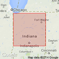
The West Lebanon Till Member of the Banner Formation, here named, is the oldest known till in IN. Exposed at Great Bend of the Wabash. Found in water wells or test holes across north-central IN and in the Marion Valley. Tills are described as reddish, smectitic, silty clay loam- to sandy loam-textured diamicts that contain clasts of red claystones derived from the Jurassic redbeds of central MI. [Maximum thickness of 60 ft estimated from cross-sections.] Overlies proglacial sediments that show reversed remanent magnetism. Deposition is presumed to predate 0.73 Ma. Assumed to represent a single, complex glacial event.
Source: GNU records (USGS DDS-6; Reston GNULEX).
For more information, please contact Nancy Stamm, Geologic Names Committee Secretary.
Asterisk (*) indicates published by U.S. Geological Survey authors.
"No current usage" (†) implies that a name has been abandoned or has fallen into disuse. Former usage and, if known, replacement name given in parentheses ( ).
Slash (/) indicates name conflicts with nomenclatural guidelines (CSN, 1933; ACSN, 1961, 1970; NACSN, 1983, 2005, 2021). May be explained within brackets ([ ]).