The National Geologic Map Database is migrating to a new infrastructure. We apologize for any service disruptions during this process.
|
|---|


- Usage in publication:
-
- West Branch Volcanics
- Modifications:
-
- Overview
- AAPG geologic province:
-
- New England province
Summary:
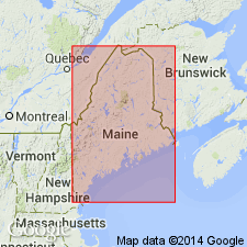
Because a formal naming paper has not been published [and Bradley is a USGS co-author], used as West Branch Volcanics of Griscom (1976) in this report. Exposed on north bank of West Branch Penobscot River. Consists of prominent, cliff-forming outcrops of intermediate volcanic flows and sills, plus less resistant, slope-forming tuff and siltstone. Age is Silurian (Pridolian).
Source: GNU records (USGS DDS-6; Reston GNULEX).
For more information, please contact Nancy Stamm, Geologic Names Committee Secretary.
Asterisk (*) indicates published by U.S. Geological Survey authors.
"No current usage" (†) implies that a name has been abandoned or has fallen into disuse. Former usage and, if known, replacement name given in parentheses ( ).
Slash (/) indicates name conflicts with nomenclatural guidelines (CSN, 1933; ACSN, 1961, 1970; NACSN, 1983, 2005, 2021). May be explained within brackets ([ ]).