The National Geologic Map Database is migrating to a new infrastructure. We apologize for any service disruptions during this process.
|
|---|


- Usage in publication:
-
- Wesselman Tongue*
- Modifications:
-
- Named
- Dominant lithology:
-
- Shale
- AAPG geologic province:
-
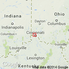
- Cincinnati arch
Summary:
Wesselman Tongue of Kope Formation named. Composed mostly of shale in beds 3 to 7 ft thick with interbeds of fossiliferous limestone 0.1 to 0.5 ft thick. Ranges from about 10 to about 30 ft in thickness. Occurs at top of Kope Formation; grades laterally into Fairview Formation; underlain by North Bend Tongue of Fairview Formation.
Source: GNU records (USGS DDS-6; Reston GNULEX).
- Usage in publication:
-
- Wesselman Tongue*
- Modifications:
-
- Overview
- AAPG geologic province:
-
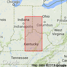
- Cincinnati arch
Summary:
Wesselman Tongue of Kope Formation adopted for use by USGS.
Source: GNU records (USGS DDS-6; Reston GNULEX).
For more information, please contact Nancy Stamm, Geologic Names Committee Secretary.
Asterisk (*) indicates published by U.S. Geological Survey authors.
"No current usage" (†) implies that a name has been abandoned or has fallen into disuse. Former usage and, if known, replacement name given in parentheses ( ).
Slash (/) indicates name conflicts with nomenclatural guidelines (CSN, 1933; ACSN, 1961, 1970; NACSN, 1983, 2005, 2021). May be explained within brackets ([ ]).