- Usage in publication:
-
- Weskan shale member
- Modifications:
-
- Named
- Dominant lithology:
-
- Shale
- Bentonite
- AAPG geologic province:
-
- Anadarko basin
Summary:
Weskan shale member of Pierre shale. Upper 80 feet ["Upper Weskan"] consists of gray clayey shale with few thin beds of bentonite; large tough limestone concretions; rusty cone-in-cone lenses, and thin streaks of concretionary limonite. Lower 90 feet ["Lower Weskan"] consists of gray clayey shale with comparatively abundant beds of bentonite; large limestone concretions common; here and there thin streaks of purple-brown limonite. Underlies Lake Creek shale member of Pierre shale and overlies Sharon Springs shale, basal member of the Pierre. Age is Late Cretaceous.
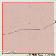
Type locality: 5 mi north of town of Weskan, [Weskan 15-min quadrangle], Wallace Co., northwestern KS. Type locality of "Upper Weskan" is on a small creek north of Swisegood ranch, in SE/4 sec. 2, T. 13 S., R. 42 W., and best exposure of "Lower Weskan" is on south side of Goose Creek, in SW/4 sec. 4, T. 13 S., R. 40 W., [Weskan 15-min quadrangle].
Source: US geologic names lexicon (USGS Bull. 896, p. 2303).
For more information, please contact Nancy Stamm, Geologic Names Committee Secretary.
Asterisk (*) indicates published by U.S. Geological Survey authors.
"No current usage" (†) implies that a name has been abandoned or has fallen into disuse. Former usage and, if known, replacement name given in parentheses ( ).
Slash (/) indicates name conflicts with nomenclatural guidelines (CSN, 1933; ACSN, 1961, 1970; NACSN, 1983, 2005, 2021). May be explained within brackets ([ ]).

