The National Geologic Map Database is migrating to a new infrastructure. We apologize for any service disruptions during this process.
|
|---|


- Usage in publication:
-
- Wellborn beds
- Modifications:
-
- Original reference
- Dominant lithology:
-
- Sandstone
- AAPG geologic province:
-
- Gulf Coast basin
Kennedy, William, 1893, Report on Grimes, Brazos, and Robertson Counties [Texas]: Geological Survey of Texas Annual Report, v. 4, p. 5-84, (incl. geologic maps)
Summary:
Pg. 39, 45. Gray sandstones and gray sands, 65 to 90 feet thick, forming top part of Eocene in Brazos County, eastern Texas, and tentatively denominated Wellborn beds. Underlie Navasota beds and overlie Yegua or lignitic division of Claiborne. [Age is late Eocene.]
[Named from Wellborn, Brazos Co., eastern TX.]
Source: US geologic names lexicon (USGS Bull. 896, p. 2299).

- Usage in publication:
-
- Wellborn sandstone
- Modifications:
-
- Overview
- AAPG geologic province:
-
- Gulf Coast basin
Summary:
For many years [btw. 1893 and 1933] regarded same as Fayette sandstone, but F.B. Plummer, 1933 (Univ. Texas Bull., no. 3232, p. 685, 686), states that it is basal part of McElroy member of Texas Survey (the middle member of Fayette sandstone as Texas Survey now divides that formation). Age is late Eocene.
Recognized in eastern Texas.
Source: US geologic names lexicon (USGS Bull. 896, p. 2299).
- Usage in publication:
-
- Wellborn sands
- Modifications:
-
- Revised
- AAPG geologic province:
-
- Gulf Coast basin
Summary:
Pg. 1298, 1302, 1305, etc. Wellborn sands are middle member of McElroy formation, and are underlain by 250 to 300 feet of Wooley's Bluff clays and overlain by Manning beds. [Age is late Eocene.]
Source: US geologic names lexicon (USGS Bull. 896, p. 2299).
- Usage in publication:
-
- Wellborn formation
- Modifications:
-
- Revised
- AAPG geologic province:
-
- Gulf Coast basin
Summary:
Table opp. p. 17, and p. 28-32. Wellborn formation [expanded] conformably underlies Manning formation, conformably overlies Caddell marl, and is here divided into 3 mappable units (descending): (1) Carlos sandstone member, 5 to 22 feet; (2) middle Wellborn, 10 to 120 feet; and (3) Bedias sandstone member, 0 to 30 feet. The Carlos sandstone of this report is approximately = the Wellborn of Miss Ellisor's 1933 paper. It is apparent from Kennedy's description that the Wellborn formation must include Carlos sandstone and Bedias sandstone. [See also Renick 1936 entry under Wooley's Bluff clays.] [Age is late Eocene.]
Source: US geologic names lexicon (USGS Bull. 896, p. 2299).
- Usage in publication:
-
- Wellborn sandstone*
- Modifications:
-
- Principal reference
- AAPG geologic province:
-
- East Texas basin
- Gulf Coast basin
Summary:
Pg. 2624 (fig. 1), 2626 (table 1), 2627-2628. Wellborn sandstone of Jackson group. In south-central Texas, Wellborn sandstone is considered a formation undivided, and is persistent unit chiefly of sandstone. Overlies Caddell formation; underlies McElroy formation (redefined). Ellisor (1933, AAPG Bull., v. 17, no. 11) applied name Wellborn sands to a member of McElroy formation, overlain by Manning beds and overlying, in east Texas, Wooleys Bluff clays, which she considered basal member of McElroy formation. West of Angelina County, she considered that the Wellborn overlaps Wooleys Bluff and lies directly on the Caddell. Renick (Univ. Texas Bull., no. 3619, 1936) divided Wellborn into three members: Carlos sandstone at top; middle Wellborn, consisting of clay and soft lignitic sandstone; and Bedias sandstone at base. Exposures of Renick's members can be seen in vicinity of Wellborn. These exposures may be considered type locality.
Type locality: in vicinity of Wellborn, about 7 mi south-southeast of College Station, Brazos Co., TX. On cuesta, 0.25 mi southeast of crossroads at Wellborn, contact of lower 4 ft of Carlos Sandstone with brown clay of Renick's middle Wellborn is exposed in roadcuts in front of cemetery; 1.25 mi north of crossroad, cuts on road to College Station expose 5 ft of gray tuffaceous clayey siltstone of middle member grading down into 6 ft of gray silty very fine-grained thin-bedded sandstone of Renick's Bedias Sandstone; about 250 yds farther north basal 5 ft of Bedias Sandstone, containing prints of pelecypods in lower 2 ft, lies on clay of Caddell Formation.
Source: US geologic names lexicon (USGS Bull. 1200, p. 4169-4170).
- Usage in publication:
-
- Wellborn Formation
- Modifications:
-
- Mapped 1:250k
- Dominant lithology:
-
- Sand
- Clay
- Lignite
- AAPG geologic province:
-
- East Texas basin
- Gulf Coast basin
Summary:
Pamphlet [p. 3]. Wellborn Formation. Sand, clay, and lignite. Quartz sand, fine- to very fine-grained, glauconitic, light-gray, weathers dark gray. Interbeds of brown lignitic clay and lignite. Fossil wood abundant, imprints of marine megafossils common. Thickness 50 to 150 feet, thickens westward. Lies above Caddell Formation and below Manning Formation. Age is Eocene.
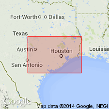
[Mapped in Grimes, Houston, and Walker Cos., TX.]
Source: Publication.

- Usage in publication:
-
- Wellborn Formation
- Modifications:
-
- Mapped 1:250k
- Dominant lithology:
-
- Sandstone
- Clay
- AAPG geologic province:
-
- Gulf Coast basin
Summary:
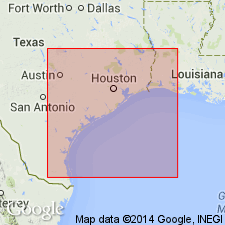
Wellborn Formation. Sandstone and clay. Thickness about 150 feet. Includes Carlos Sandstone [Member] at top (not separately mapped). Overlies Caddell Formation (Eocene); underlies Manning Formation (Eocene). Age is Eocene.
Mapped in Wilson, Karnes, Gonzales, and Fayette Cos., southeastern TX.
Source: Modified from GNU records (USGS DDS-6; Denver GNULEX).

- Usage in publication:
-
- Wellborn Sandstone
- Modifications:
-
- Mapped 1:250k
- Dominant lithology:
-
- Sandstone
- AAPG geologic province:
-
- Gulf Coast basin
Summary:
Wellborn Sandstone of Jackson Group. Sandstone, fine- to coarse-grained, tuffaceous, light-gray, cross-bedded; contains borings of worms and OPHIOMORPHA, locally contains pelecypods. Thickness 150+/- feet. Lies above Caddell Formation and below Manning Formation (both of Jackson). Age is Eocene.
[Mapped in McMullen, Atascosa, and Wilson Cos., southern TX.]
Source: Publication.

- Usage in publication:
-
- Wellborn Formation
- Modifications:
-
- Mapped 1:250k
- Dominant lithology:
-
- Sandstone
- AAPG geologic province:
-
- Gulf Coast basin
Summary:
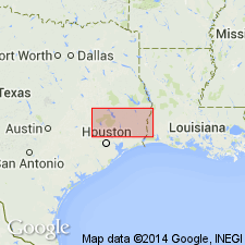
Pamphlet [p. 2]. Wellborn Formation. Sandstone, fine- to coarse-grained, light-gray, cross-bedded, contains borings of worms and OPHIOMORPHA and fossil shells; locally well indurated; thickness 150+/- feet. Underlies Manning Formation; overlies Caddell Formation. Age is Eocene.
[Two slivers mapped in southeasternmost corner of map sheet along Wilson-Karnes Co. line, southern TX.]
Source: Publication.
For more information, please contact Nancy Stamm, Geologic Names Committee Secretary.
Asterisk (*) indicates published by U.S. Geological Survey authors.
"No current usage" (†) implies that a name has been abandoned or has fallen into disuse. Former usage and, if known, replacement name given in parentheses ( ).
Slash (/) indicates name conflicts with nomenclatural guidelines (CSN, 1933; ACSN, 1961, 1970; NACSN, 1983, 2005, 2021). May be explained within brackets ([ ]).