The National Geologic Map Database is migrating to a new infrastructure. We apologize for any service disruptions during this process.
|
|---|


- Usage in publication:
-
- Weldon River Sandstone Member
- Modifications:
-
- Named
- Dominant lithology:
-
- Conglomerate
- Sandstone
- Shale
- AAPG geologic province:
-
- Forest City basin
- Lincoln anticline
- Iowa shelf
Summary:
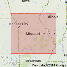
Named as lowermost of three members of Shale Hill Formation (new) of Pleasanton Group for stream flowing through Mercer and Grundy Cos, north-central MO, in Forest City basin. Type area consists of exposures along Weldon River. Occurs as channel- and valley-fill deposits in northern and western MO and southern IA, Lincoln anticline and Iowa shelf. Consists of basal limestone conglomerate and overlying sandstone and shale. Conglomerate is up to 20 ft thick; called Chariton by Bain (1895) in southern IA. Sandstone is brown to gray on fresh surface, fine- to medium-grained, consisting predominantly of quartz with subordinate amounts of feldspar; muscovite is an abundant accessory mineral; plant material is common; weathers to reddish brown to brown or drab to light gray. Thickest sandstone deposits are massively bedded and coarsely cross-bedded. Thickness is up to 100 ft at Miami Station and White Rock, Carroll Co, MO. Unconformably overlies Unity Farm Shale Member (new) of Lees Summit Formation (new) of Pleasanton. Conformably underlies Knobtown Limestone Member of Shale Hill. Correlation chart. Many measured sections. Correlates with Trivoli Sandstone Member of Modesto Formation in IL. Late Pennsylvanian (early Missourian) age.
Source: GNU records (USGS DDS-6; Denver GNULEX).
For more information, please contact Nancy Stamm, Geologic Names Committee Secretary.
Asterisk (*) indicates published by U.S. Geological Survey authors.
"No current usage" (†) implies that a name has been abandoned or has fallen into disuse. Former usage and, if known, replacement name given in parentheses ( ).
Slash (/) indicates name conflicts with nomenclatural guidelines (CSN, 1933; ACSN, 1961, 1970; NACSN, 1983, 2005, 2021). May be explained within brackets ([ ]).