

- Usage in publication:
-
- Weisner quartzite
- Modifications:
-
- Named
- Dominant lithology:
-
- Quartzite
- AAPG geologic province:
-
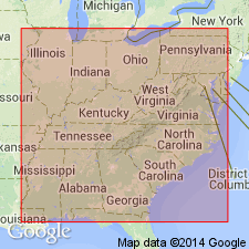
- Appalachian basin
Summary:
Name Weisner quartzite applied to great beds of quartzite and conglomerate in the eastern part of Coosa Valley, many hundred ft thick, but often of very limited extent geographically. Rocks are interpolated in Coosa and Montevallo shales, at no definite horizon but most commonly in their lower parts, as local masses of lenticular shape and often of very great thickness. The quartzites always form high and rugged mountains, sometimes stretching for miles in an unbroken range, but as often forming detached and isolated peaks. Age is Early Cambrian.
Source: GNU records (USGS DDS-6; Reston GNULEX).
- Usage in publication:
-
- Weisner quartzite*
- Modifications:
-
- Revised
- AAPG geologic province:
-
- Appalachian basin
Summary:
Weisner quartzite, in places, is separated from overlying Rome formation by a blue siliceous limestone 800 to 1200 ft thick [now referred to as Shady Dolomite]. In parts of AL Weisner attains a thickness of 5,500 ft.
Source: GNU records (USGS DDS-6; Reston GNULEX).
- Usage in publication:
-
- Weisner formation*
- Modifications:
-
- Overview
- AAPG geologic province:
-
- Appalachian basin
Summary:
Weisner is described in Cartersville district, GA, where it consists principally of finely micaceous quartzite and, less commonly, beds of metaconglomerate, metasiltstone, and crystalline carbonate rocks. Beds do not occur in any uniform stratigraphic order and are exposed in a belt of parallel ridges that trend northward through middle of district. Base of section is not exposed, but thickness is more than 1,000 ft, and probably more than 2,000 ft. As mapped, includes Pinelog conglomerate. Conformably underlies Shady formation. Age is Early Cambrian.
Source: GNU records (USGS DDS-6; Reston GNULEX).

- Usage in publication:
-
- Weisner Formation*
- Modifications:
-
- Revised
- AAPG geologic province:
-
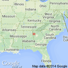
- Piedmont-Blue Ridge province
Summary:
The Weisner Formation is the uppermost unit of the Chilhowee Group in the Bill Arp and Rome thrust sheets in GA and AL. It overlies the Wilson Ridge Formation. Age is Early Cambrian.
Source: GNU records (USGS DDS-6; Reston GNULEX).

- Usage in publication:
-
- Weisner Formation
- Modifications:
-
- Overview
- Dominant lithology:
-
- Sandstone
- Conglomerate
- Mudstone
- AAPG geologic province:
-
- Appalachian basin
Summary:
Weisner Formation of Chilhowee Group consists of interbedded quartzose sandstone and laterally continuous conglomerate, containing minor greenish-gray mudstone. Thickness ranges from 98 to 492 ft. [This thickness differs considerably from that given in most other reports, but agrees with that of Mack, 1980: Amer. Journ. Sci, v. 280, no. 6).] Crops out in the eastern Valley and Ridge. Overlies Wilson Ridge Formation of Chilhowee and underlies Shady Dolomite. Age is Early Cambrian.
Source: GNU records (USGS DDS-6; Reston GNULEX).
- Usage in publication:
-
- Weisner Quartzite
- Modifications:
-
- Areal extent
- AAPG geologic province:
-
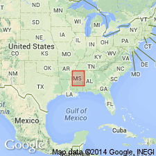
- Warrior basin
Summary:
Geographically extended the Weisner Quartzite into the Warrior basin of MS. Consists of varicolored, fine- to very coarse-grained, quartzitic sandstone. Thickness is 0 to 180 feet. Overlies Precambrian basement and underlies the Shady Dolostone. The Weisner is of Early Cambrian age.
Source: GNU records (USGS DDS-6; Reston GNULEX).
For more information, please contact Nancy Stamm, Geologic Names Committee Secretary.
Asterisk (*) indicates published by U.S. Geological Survey authors.
"No current usage" (†) implies that a name has been abandoned or has fallen into disuse. Former usage and, if known, replacement name given in parentheses ( ).
Slash (/) indicates name conflicts with nomenclatural guidelines (CSN, 1933; ACSN, 1961, 1970; NACSN, 1983, 2005, 2021). May be explained within brackets ([ ]).