- Usage in publication:
-
- Wedron Formation*
- Modifications:
-
- Original reference
- AAPG geologic province:
-
- Illinois basin
- Wisconsin arch
Summary:
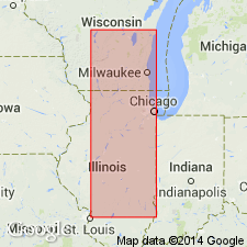
Pg. E16-E17. Wedron Formation. Tan, pink, and gray calcareous till, 61.5 feet thick. Underlies Richland Loess and overlies Farmdale Silt. Age is Pleistocene (Wisconsinan; Woodfordian).
Type section: in overburden of Wedron Silica Company No. 1 pit, south of Wedron on west side of Fox River, in SE/4 SE/4 SW/4 sec. 9., T. 34 N., R. 4 E., [approx. Lat. 41 deg. 25 min. 42 sec. N., Long. 88 deg. 46 min. 36 sec. W., Wedron 7.5-min quadrangle], LaSalle Co., northeastern IL. Named from village of Wedron.
Source: Publication; US geologic names lexicon (USGS Bull. 1520, p. 330-331).
- Usage in publication:
-
- Wedron Formation*
- Modifications:
-
- Areal extent
- AAPG geologic province:
-
- Lake Michigan
- Wisconsin arch
GNU Staff, 1991, Draft copy of Folger, D.W., and others, Sedimentary types in southern Lake Michigan, USGS Misc. Geol. Inv. Map I-XXXX (unpublished): U.S. Geological Survey Digital Data Series, DDS-6, 1 CD-ROM., release 3. See also D.S. Foster and D.W. Folger, Jour. Great Lakes Research, v. 20, no. 1, p. 44-60, 1994. Available online w/subscription from ScienceDirect
Summary:
Bedrock in nearshore southern Lake Michigan is overlain by late Wisconsinan Wadsworth Till Member of Wedron Formation. Till is composed mostly of silty clay and is exposed on the lake floor over most of the area or is mantled by glacial outwash sand and gravel.
Source: GNU records (USGS DDS-6; Reston GNULEX).

- Usage in publication:
-
- Wedron Formation
- Modifications:
-
- Revised
- AAPG geologic province:
-
- Illinois basin
Summary:
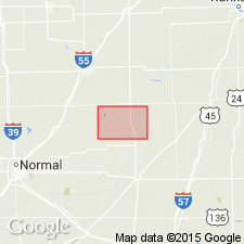
Woodfordian Wedron Formation in Livingston Co., IL, directly overlies Illinoian and Sangamonian Glasford Formation through most of the area, although in some places the Farmdalian Robein Silt is present below the Wedron. Unit is divided into (ascending) Ashmore (informal), Tiskilwa, Batestown, and Snider Till Members. The informal Ashmore consists of the sand and gravel with interbedded silt well developed at the base of the Wedron in the southern part of east-central IL. This lithology was first recognized by Kempton and others (1981) but was not named.
Source: GNU records (USGS DDS-6; Reston GNULEX).

- Usage in publication:
-
- Wedron Formation
- Modifications:
-
- Areal extent
- AAPG geologic province:
-
- Illinois basin
Summary:
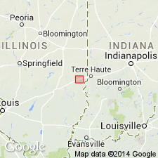
The Fairgrange Till Member of the Wedron Formation, although absent at the Martinsville alternative site, is present in the Shelbyville Moraine 8 mi northwest of the study area. The moraine marks the maximum southward advance of the late Wisconsinan Lake Michigan Lobe about 20,000 years ago. The Fairgrange Till Member is composed chiefly of clay loam or loam diamicton and lesser amounts of sand and gravel.
Source: GNU records (USGS DDS-6; Reston GNULEX).
For more information, please contact Nancy Stamm, Geologic Names Committee Secretary.
Asterisk (*) indicates published by U.S. Geological Survey authors.
"No current usage" (†) implies that a name has been abandoned or has fallen into disuse. Former usage and, if known, replacement name given in parentheses ( ).
Slash (/) indicates name conflicts with nomenclatural guidelines (CSN, 1933; ACSN, 1961, 1970; NACSN, 1983, 2005, 2021). May be explained within brackets ([ ]).

