

- Usage in publication:
-
- Waupaca Quartz Monzonite
- Modifications:
-
- Redescribed
- Geochronologic dating
- Dominant lithology:
-
- Quartz monzonite
- AAPG geologic province:
-
- Lake Superior region
Summary:
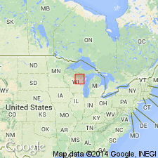
Is included as a lithodemic unit of the Wolf River batholith in central and northeastern WI in Lake Superior region. Generalized geologic map shows contacts with undifferentiated Paleozoic rocks, Red River Quartz Monzonite (new), and Precambrian rocks older than 1,450-1,500 m.y. U-Pb concordia intercept age of about 1,500 m.y. is considered most reliable age estimate of the batholith. [Redescribed as quartz monzonite; formerly "Waupaca granite" of Elders (1968).] Very coarse grained, extensively developed rapakivi texture; closely resembles classic wiborgite in Finland. Pink ovoidal alkali feldspar grains (1.5-5.0 cm long), 70-80 percent of which are mantled by plagioclase layer 1-6 mm thick; multiple layers common. Porphyritic, with large mantled feldspars, plagioclase, and idiomorphic quartz in medium-grained matrix of microcline, plagioclase, quartz, biotite, and amphibole. Age is Middle Proterozoic.
Source: GNU records (USGS DDS-6; Reston GNULEX).
- Usage in publication:
-
- Waupaca Granite*
- Modifications:
-
- Redescribed
- Overview
- Dominant lithology:
-
- Granite
- AAPG geologic province:
-
- Lake Superior region
Summary:
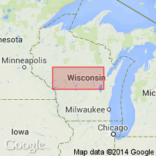
Consists of rapakavi granite (wiborgite) containing 70 to 80 percent coarse (1.5-5.0 cm) ovoid alkali feldspars mantled by plagioclase (An15-24), coarse anhedral quartz and interstitial hornblende and biotite. Formerly called Waupaca Quartz Monzonite (Van Schmus and others, 1975) and "Waupaca adamellite" (Anderson, 1980). Is redescribed here as the Waupaca Granite, following the classification of Streckeisen (1976). Exposures in quarry (lat 44 deg 25' 30"; long 89 deg 03') 6 km north of town of Waupaca, WI, are designated as the type area; named for town of Waupaca. Is mapped as the southernmost unit in the Wolf River batholith and is limited to the Green Bay 1 deg x 2 deg sheet. It intrudes Early Proterozoic rhyolite. Its southern boundary, exposed adjacent to Waupaca Co Hwy K, 4 km northeast of Waupaca, is mylonite; western boundary is inferred to be a fault. Is mapped in Waupaca, Portage, and Outagamie Cos, WI, in Lake Superior region. Age is Middle Proterozoic.
Source: GNU records (USGS DDS-6; Reston GNULEX).
For more information, please contact Nancy Stamm, Geologic Names Committee Secretary.
Asterisk (*) indicates published by U.S. Geological Survey authors.
"No current usage" (†) implies that a name has been abandoned or has fallen into disuse. Former usage and, if known, replacement name given in parentheses ( ).
Slash (/) indicates name conflicts with nomenclatural guidelines (CSN, 1933; ACSN, 1961, 1970; NACSN, 1983, 2005, 2021). May be explained within brackets ([ ]).