

- Usage in publication:
-
- Wauneta Limestone Member
- Modifications:
-
- Original reference
- Dominant lithology:
-
- Limestone
- AAPG geologic province:
-
- Cherokee basin
Summary:
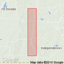
Wauneta Limestone Member of Howard Limestone of Wabaunsee Group. Previously included in upper part of Aarde Shale. Consists of light-gray, brownish weathering, dense, fossiliferous limestone containing a few fusulinids and locally algal material. Thickness about 1 foot. Overlies Aarde Shale (restricted) which includes Nodaway Coal Bed; underlies [Shanghai Creek] Shale Member (new); both of Howard Limestone. Occurs in Greenwood, Elk, and Chautauqua Counties, in southern part of Kansas. Age is Late Pennsylvanian (Virgilian).
Type section: in roadcut along U.S. Highway 166 about 7.5 mi east of Cedar Vale and 10 mi west of Sedan, in NW/4 sec. 7, T. 34 S., R. 10 E., Chautauqua Co., KS. Origin of name not stated by author, but probably named from town of Wauneta, Chautauqua Co., KS.
Source: Kansas lexicon (Kansas Geol. Survey Bull., no. 231, p. 258); GNU records (USGS DDS-6; Denver GNULEX).
For more information, please contact Nancy Stamm, Geologic Names Committee Secretary.
Asterisk (*) indicates published by U.S. Geological Survey authors.
"No current usage" (†) implies that a name has been abandoned or has fallen into disuse. Former usage and, if known, replacement name given in parentheses ( ).
Slash (/) indicates name conflicts with nomenclatural guidelines (CSN, 1933; ACSN, 1961, 1970; NACSN, 1983, 2005, 2021). May be explained within brackets ([ ]).