

- Usage in publication:
-
- Watton Canyon Member*
- Modifications:
-
- Named
- Dominant lithology:
-
- Limestone
- Sandstone
- AAPG geologic province:
-
- Wasatch uplift
- Snake River basin
Summary:
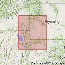
Named as one of seven members of Twin Creek Limestone for Watton Canyon, south of Birch Creek, Rich Co, UT on the Wasatch uplift. Type section designated and measured on north side of Birch Creek NW1/4 sec 19, T9N, R6E. Formerly called member E. Overlies Boundary Ridge Member (new) of Twin Creek sharply; contact is between soft siltstone and limestone of Boundary Ridge and cliff-forming limestone of Watton Canyon. Underlies Leeds Creek Member (new) of Twin Creek gradationally. Thickens westward from 60 ft in WY to about 400 ft in southeast ID, and from 17 ft on Whiterocks River to 380 ft at Devils Slide. Is 399 ft thick at type. Occurs in Greater Green River, Snake River and Uinta basins, in Yellowstone province, and on Uinta uplift. Consists mostly of medium- to brownish-gray compact brittle, medium- to thin-bedded limestone. Most beds dense to sublithographic and some granule or oolitic. Includes very thin bedded to shaly calcareous, fine-grained, ripple-marked sandstone at type. Five measured sections described. Not very fossiliferous. Fossil list (pelecypods, gastropods). Of early Callovian, Late Jurassic age. Correlation with lower Rierdon Formation, Canyon Springs Sandstone Member of Sundance Formation, upper Twelvemile Canyon Member of Arapien Shale, and upper Carmel Formation shown on correlation chart. Deposited in a shallow sea. Cross sections.
Source: GNU records (USGS DDS-6; Denver GNULEX).

- Usage in publication:
-
- Watton Canyon Member*
- Modifications:
-
- Overview
- Age modified
- AAPG geologic province:
-
- Snake River basin
- Yellowstone province
- Wasatch uplift
- Uinta basin
- Uinta uplift
Summary:
Is one of seven members of Twin Creek Limestone. Conformably overlies Boundary Ridge Member of Twin Creek and conformably underlies Leeds Creek Member of Twin Creek in Snake River basin, ID, Yellowstone province, WY, and Wasatch uplift, Uinta basin, and Uinta uplift, UT. Correlation charts include information on lithology and thickness. Wedges out near Vernal, Uintah Co, UT. Age changed from Late Jurassic (early Callovian) to Middle Jurassic (middle Bathonian). Correlates with part of Sundance, Carmel, and Arapien Formations.
Source: GNU records (USGS DDS-6; Denver GNULEX).
For more information, please contact Nancy Stamm, Geologic Names Committee Secretary.
Asterisk (*) indicates published by U.S. Geological Survey authors.
"No current usage" (†) implies that a name has been abandoned or has fallen into disuse. Former usage and, if known, replacement name given in parentheses ( ).
Slash (/) indicates name conflicts with nomenclatural guidelines (CSN, 1933; ACSN, 1961, 1970; NACSN, 1983, 2005, 2021). May be explained within brackets ([ ]).