The National Geologic Map Database is migrating to a new infrastructure. We apologize for any service disruptions during this process.
|
|---|


- Usage in publication:
-
- Watson Ranch tongue
- Modifications:
-
- Named
- Dominant lithology:
-
- Quartzite
- AAPG geologic province:
-
- Great Basin province
Summary:
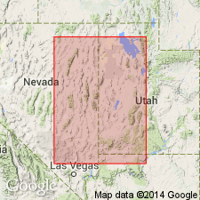
First published description as a name for a quartzite tongue of the Swan Peak quartzite. Named for Jack Watson's Ibex ranch in Millard Co, UT, Great Basin province. Isopach map shows tongue only in west-central UT. Overlies Lehman formation. Underlies the newly named Crystal Peak dolomite. [May be an eastward-projecting? tongue of the Swan Peak;] author tentatively correlates it with Swan Peak of northern UT. No type locality designated. In Smooth Canyon, Ibex area, it consists of 243 ft of gray to white, vitreous quartzite and minor amount of dolomitic calcisiltite; forms ledges and bluffs; weathered surfaces are iron-stained to reddish-brown. Measured sections: is 174 ft thick and fossiliferous at Desert Range Experiment Station; 191 ft thick at Tule Valley; 129 ft thick at Steptoe. Estimated to be more than 300 ft thick. Cross section. Middle Ordovician age.
Source: GNU records (USGS DDS-6; Denver GNULEX).
- Usage in publication:
-
- Watson Ranch Quartzite
- Modifications:
-
- Overview
- AAPG geologic province:
-
- Great Basin province
Summary:
Mapped (geologic map) in the Fish Springs Range, Juab Co, UT, Great Basin province, where it overlies Deadman Spring Dolomite and underlies Eureka Quartzite. Consists of 0-150 ft of fucoidal brown calcareous sandstone. Graphic section. Ordovician age.
Source: GNU records (USGS DDS-6; Denver GNULEX).
For more information, please contact Nancy Stamm, Geologic Names Committee Secretary.
Asterisk (*) indicates published by U.S. Geological Survey authors.
"No current usage" (†) implies that a name has been abandoned or has fallen into disuse. Former usage and, if known, replacement name given in parentheses ( ).
Slash (/) indicates name conflicts with nomenclatural guidelines (CSN, 1933; ACSN, 1961, 1970; NACSN, 1983, 2005, 2021). May be explained within brackets ([ ]).