The National Geologic Map Database is migrating to a new infrastructure. We apologize for any service disruptions during this process.
|
|---|


- Usage in publication:
-
- Water Island Formation
- Modifications:
-
- Overview
- Age modified
- Biostratigraphic dating
- Geochronologic dating
- Dominant lithology:
-
- Volcanics
- Breccia
- Tuff
- AAPG geologic province:
-
- Caribbean region
Summary:
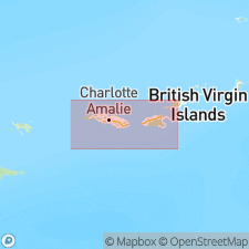
Water Island Formation consists almost entirely of keratophyre flows, flow breccias, and tuffs, with spilite flows and minor radiolarites. Intruded by keratophyre dikes and plugs. Exposed thickness is 15,000 ft based on projection of lowest and highest horizons seen. Water Island, at entrance to harbor at Charlotte Amalie, St. Thomas, is type locality because of great variety of rock types and excellence of exposure. Also crops out on southern shores of St. Thomas and St. John. Radiolarian tuffs are very subordinate, but locally conspicuous near top of formation. Generic determinations of radiolarians not made, but they are similar to THECOSPHAERA, FLUSTRELLA. and DICTYOMITRA; all strikingly similar to Lower Cretaceous forms from eastern Mexico (Bonet, 1956). Best preserved at Haypiece Hill, St. Thomas. K-Ar age determinations were made on two samples by George Edwards, Shell Oil Co., Houston TX. The first from celadonitic keratophyre tuff yielded age of 58-62+/-5 m.y., an age that is probably too young and may represent either argon leakage or formation of celadonite by erosion or exposure of tuffaceous bed. The second, from hydrothermally altered keratophyre, yielded ages of 106 and 110 m.y.; this shows that hydrothermal alteration was not due to early Tertiary emplacement of plutonic diorites. Age is possibly late Early Cretaceous.
Source: GNU records (USGS DDS-6; Reston GNULEX).
- Usage in publication:
-
- Water Island Formation
- Modifications:
-
- Areal extent
- AAPG geologic province:
-
- Caribbean region
Summary:
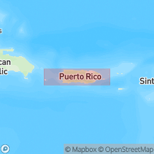
Donnelly (1969, oral commun.) reported occurrence of Water Island Formation in northeastern PR, thus extending formation from St. Thomas, VI to PR. Age is Late Cretaceous, probably Albian or older.
Source: GNU records (USGS DDS-6; Reston GNULEX).
- Usage in publication:
-
- Water Island Formation*
- Modifications:
-
- Overview
- Geochronologic dating
- AAPG geologic province:
-
- Caribbean region
Summary:
Author follows usage of Donnelly (1959, 1966) for the rocks on St. Thomas and St. John, VI. They include (ascending) the Early Cretaceous Water Island Formation and the Late Cretaceous Virgin Island Group, which consists of the Louisenhoj Formation, Outer Brass Limestone, Tutu Formation (with its informal Coki Point Megabreccia lithofacies and Congo Cay Limestone Member), and Hans Lollik Formation. Five felsic rocks from Water Island Formation, dated by Michael Diggles (U.S. Geological Survey) using K-Ar whole rock techniques, yielded a range from 65.8+/-2.9 to 30.9+/-0.3 Ma. Two rocks from Louisenhoj Formation also were dated using K-Ar techniques by Diggles and yielded a range from 42.1+/-0.6 to 37.7+/-1.1 Ma.
Source: GNU records (USGS DDS-6; Reston GNULEX).
For more information, please contact Nancy Stamm, Geologic Names Committee Secretary.
Asterisk (*) indicates published by U.S. Geological Survey authors.
"No current usage" (†) implies that a name has been abandoned or has fallen into disuse. Former usage and, if known, replacement name given in parentheses ( ).
Slash (/) indicates name conflicts with nomenclatural guidelines (CSN, 1933; ACSN, 1961, 1970; NACSN, 1983, 2005, 2021). May be explained within brackets ([ ]).