

- Usage in publication:
-
- Watab Amphibolite
- Modifications:
-
- Named
- Dominant lithology:
-
- Amphibolite
- Gneiss
- AAPG geologic province:
-
- Lake Superior region
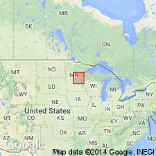
Summary:
Named for group of black to dark-greenish-black gneissic rocks belonging to Sauk Rapids Metamorphic Complex (new). Outcrops located east of Mississippi River in Benton Co, secs 26, 27, 34, and 35, T37N, R30W (Watab Township), and west of Mississippi River in Stearns Co, sec 10, T125N, R28W, Lake Superior region. Type locality designated at abandoned quarry near center of sec 27, T37N, R30W (Watab Township) about 1 km south of village of Watab. Also well exposed along U.S. Hwy 10, 0.6 km east of Watab. Based on field relationships and geophysical data, unit forms east-trending lenticular mass at least 3 km wide and 5 km long. Is a vaguely foliated hornblende-pyroxene-plagioclase gneiss; varied mineralogy and texture due to alteration by emplacement of Stearns Granitic Complex. Is interlayered to west and north with rocks assigned to Sartell Gneiss. One of oldest mapped units in Mille Lacs Lake region. Is early Precambrian in age.
Source: GNU records (USGS DDS-6; Denver GNULEX).
For more information, please contact Nancy Stamm, Geologic Names Committee Secretary.
Asterisk (*) indicates published by U.S. Geological Survey authors.
"No current usage" (†) implies that a name has been abandoned or has fallen into disuse. Former usage and, if known, replacement name given in parentheses ( ).
Slash (/) indicates name conflicts with nomenclatural guidelines (CSN, 1933; ACSN, 1961, 1970; NACSN, 1983, 2005, 2021). May be explained within brackets ([ ]).