- Usage in publication:
-
- Washtucna Soil
- Modifications:
-
- Named
- Dominant lithology:
-
- Paleosol
- Loess
- Ash
- AAPG geologic province:
-
- Eastern Columbia basin
Summary:
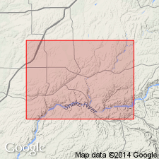
Named for nearby town of Washtucna in Cheney-Palouse Scabland Tract of the Channeled Scabland, Adams Co., southeastern WA. Type locality is a composite of six roadcuts recognized across a 100 km transect here called "type transect". Strata previously assigned to [late Pleistocene] Palouse loess (informal). Described as complete and well-developed buried soil at most sites. Its cambic horizon has weak to moderate blocky structure, slightly higher color value and chroma and less pedogenic carbonate than in adjacent units. Dominant feature is light-gray petrocalcic horizon weakly to strongly cemented, and consists of 70 to 90% strongly cemented cylindrical nodules. Grades downward to calcic horizons with vertical seams of carbonate, 40 to 50% cemented cylinders with nearly continuous carbonate coating and in matrix of calcareous soft loess. Lowest horizon is structureless with small percentage of weakly cemented nodules and filaments of carbonate. Maximum thickness is 3.5 m at KP-1 roadcut of "type transect". Unconformably overlies late Pleistocene (>35,000 yrs B.P.) Old Maid Coulee Soil (new). Unconformably underlies latest Pleistocene (13,000 yrs B.P.) and early and middle Holocene(?) Sand Hills Coulee Soil (new). Age is late Pleistocene based on >35,000 yrs B.P. Mount St. Helens set C tephra layer and charcoal, dated at 40,650+\-1000 yrs B.P., found in gravel from cataclysmic floods deposited in Lind Coulee near Moses Lake, WA. Report includes stratigraphic column and correlation chart.
Source: GNU records (USGS DDS-6; Menlo GNULEX).
For more information, please contact Nancy Stamm, Geologic Names Committee Secretary.
Asterisk (*) indicates published by U.S. Geological Survey authors.
"No current usage" (†) implies that a name has been abandoned or has fallen into disuse. Former usage and, if known, replacement name given in parentheses ( ).
Slash (/) indicates name conflicts with nomenclatural guidelines (CSN, 1933; ACSN, 1961, 1970; NACSN, 1983, 2005, 2021). May be explained within brackets ([ ]).

