- Usage in publication:
-
- Washington shale and sandstone
- Modifications:
-
- Named
- Dominant lithology:
-
- Shale
- Sandstone
- AAPG geologic province:
-
- Arkoma basin
Summary:
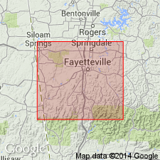
Washington shale and sandstone. Exposed in Washington County, Arkansas, in the Arkoma basin. Consists of pebbly shale (base) followed above by thick, yellow-brown, soft sandstone (top), or "there may be a gradual passage from the shale, through flagging, into the sandstone layers." Proportion of shale to sandstone varies considerably in different localities. Varies in thickness from 40 to 75 feet; near town of West Fork is 75 feet thick; in Pierce Mountain, east of Fayetteville, is 40 feet thick. Overlies Archimedes limestone (new); underlies Pentremital limestone (new). Interval between these two formations is thickest near the base of the Boston Mountains; thins out to the north. Impressions of LEPIDODENDRON and of other plants. Age is Early Carboniferous. Report includes geologic map of Washington County, stratigraphic table, columnar sections.
Type locality not designated. Named from Washington Mountain southwest of Fayetteville in Washington Co., AR.
Source: Modified from GNU records (USGS DDS-6; Denver GNULEX).
For more information, please contact Nancy Stamm, Geologic Names Committee Secretary.
Asterisk (*) indicates published by U.S. Geological Survey authors.
"No current usage" (†) implies that a name has been abandoned or has fallen into disuse. Former usage and, if known, replacement name given in parentheses ( ).
Slash (/) indicates name conflicts with nomenclatural guidelines (CSN, 1933; ACSN, 1961, 1970; NACSN, 1983, 2005, 2021). May be explained within brackets ([ ]).

