The National Geologic Map Database is migrating to a new infrastructure. We apologize for any service disruptions during this process.
|
|---|


- Usage in publication:
-
- Washakee group*
- Modifications:
-
- Original reference
- Dominant lithology:
-
- Lignite
- AAPG geologic province:
-
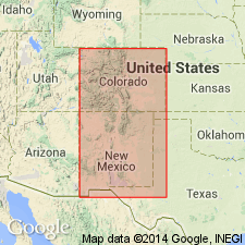
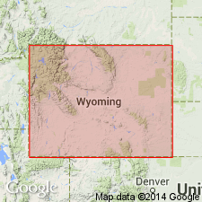
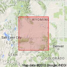
- Green River basin
Summary:
Pg. 190 of 1873 ed. (1869 ed. not available). Washakee group. A series of purely fresh-water beds, with some beds of impure lignite and vast quantities of fossils. The strata are nearly horizontal. I have regarded these beds as separated from the lower Tertiary Fort Union or true lignite group.
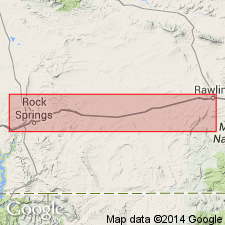
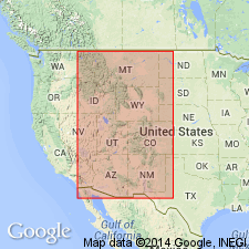
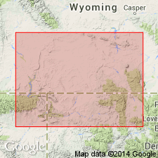
[Named from exposures at Washaki station, btw. Creston and Bitter Creek, on Union Pacific RR, in Sweetwater Co., southwestern WY. Comprises the Eocene sediments of Washakie basin (approved spelling).]
Source: US geologic names lexicon (USGS Bull. 896, p. 2279).
- Usage in publication:
-
- Washakie group*
- Modifications:
-
- Areal extent
- AAPG geologic province:
-
- Green River basin
Summary:
Pg. 71-73. I am now inclined to believe Washakie group is either an extension eastward of Bridger group or synchronous with it. [Age is middle and late(?) Eocene.]
Source: US geologic names lexicon (USGS Bull. 896, p. 2279).
- Usage in publication:
-
- Washakie group*
- Modifications:
-
- Areal extent
- AAPG geologic province:
-
- Green River basin
Summary:
Pg. 455-462. Washakie group (Tertiary) overlies Bitter Creek group and underlies Green River group.
Source: US geologic names lexicon (USGS Bull. 896, p. 2279).
- Usage in publication:
-
- Washakie group*
- Modifications:
-
- Areal extent
- AAPG geologic province:
-
- Green River basin
Summary:
Washakie group. Eastern limit of group is near Creston, extending to point just west of Bitter Creek Station. Exposures consists of soft clays and sands of various shades of brown and yellow, with here and there a hard sandstone; in several places beds of impure lignite occur. Is probably same as Vermilion Creek of King and Wahsatch group of Hayden. [Now known to be much younger than Wasatch group.]
Source: US geologic names lexicon (USGS Bull. 896, p. 2279).

- Usage in publication:
-
- [Washakie group*]
- Modifications:
-
- Not used
- AAPG geologic province:
-
- Green River basin
Summary:
Pg. 394. Bridger group was deposited in lake which is here named Washakie Lake.
Source: US geologic names lexicon (USGS Bull. 896, p. 2279).

- Usage in publication:
-
- Washakie formation*
- Modifications:
-
- Overview
- AAPG geologic province:
-
- Green River basin
Summary:
See also Walter Granger and W.J. Sinclair, 1909 (Amer. Mus. Nat. Hist. Bull., v. 26, art. 3 and art. 4, p. 17-27). [Available online through the Amer. Mus. Nat. Hist.: http://hdl.handle.net/2246/714.]
H.F. Osborn, 1909 (USGS Bull. 361). Typical Bridger formation of Bridger basin, Wyoming, contains some earlier deposits than Bridger formation of Washakie basin.
Now (ca. 1936) Washakie considered essentially same as Bridger formation. †Washakie formation abandoned. (See USGS Bull. 720, 1920, by A.R. Schultz.)
Named from exposures at Washaki station, btw. Creston and Bitter Creek, on Union Pacific RR, in Sweetwater Co., southwestern WY. Comprises the Eocene sediments of Washakie basin (approved spelling).
Source: US geologic names lexicon (USGS Bull. 896, p. 2279).
- Usage in publication:
-
- Washakie formation
- Modifications:
-
- Overview
- AAPG geologic province:
-
- Green River basin
Summary:
Pg. 36, pl. 1. Washakie formation. Age is [middle Eocene]; late Bridgerian and early Uintan.
Source: US geologic names lexicon (USGS Bull. 1200, p. 4140).
- Usage in publication:
-
- Washakie formation
- Modifications:
-
- Reinstated
- AAPG geologic province:
-
- Green River basin
Summary:
Washakie formation. Reinstated and applied to Eocene (Bridgerian and Uintan) strata lying above the Green River formation in Washakie basin, southwestern Wyoming. [Not adopted by the USGS.]
Source: US geologic names lexicon (USGS Bull. 1200, p. 4140).
- Usage in publication:
-
- Washakie Formation*
- Modifications:
-
- Reinstated
- Revised
- Adopted
- AAPG geologic province:
-
- Green River basin
Summary:
Washakie Formation. Reintroduced into Washakie basin, southwestern Wyoming, as defined by Hayden (1869). Its rocks formerly included in Bridger and Uinta Formations, now restricted from use in this basin. Washakie divided into (ascending): Kinney Rim and Adobe Town Members (both new). Age is middle and late Eocene.
Source: Changes in stratigraphic nomenclature, 1973 (USGS Bull. 1395-A, p. A46-A47).
For more information, please contact Nancy Stamm, Geologic Names Committee Secretary.
Asterisk (*) indicates published by U.S. Geological Survey authors.
"No current usage" (†) implies that a name has been abandoned or has fallen into disuse. Former usage and, if known, replacement name given in parentheses ( ).
Slash (/) indicates name conflicts with nomenclatural guidelines (CSN, 1933; ACSN, 1961, 1970; NACSN, 1983, 2005, 2021). May be explained within brackets ([ ]).