- Usage in publication:
-
- Washakie Point Till*, glaciation*
- Modifications:
-
- Named
- Dominant lithology:
-
- Till
- AAPG geologic province:
-
- Wind River basin
Summary:
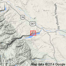
Name applied to a till beneath the Cedar Ridge Till. Named for Washakie Point; section measured at type locality in SE-1/4 SE-1/4 sec. 29, T3N, R3W, Fremont Co., WY in the Wind River basin. Is 22.9 ft thick at type where it consists of: brown, massive to banded, silt at base; a middle pebbly, loose, clean, fine grained sand with some angular to subangular pebbles derived from crystalline, Paleozoic, and Tertiary rocks; and an upper brown, massive, thin-bedded, clayey silt. Unconformably overlies Tertiary conglomerate and underlies a white to brown soil. Mapped (geologic map) in a very limited area slightly more than one-quarter mile narrow band for a short distance west of Bull Lake. This till is older than any of the previously recognized tills in the area. Also called Washakie Point glaciation. Occupies terrace 760 ft above the Wind River. Regionally correlates with the Rocky Flats Alluvium and the Nebraskan Till. Of Pleistocene, pre-Wisconsin age. Designated both Washakie Point Till and Washakie Point glaciation.
Source: GNU records (USGS DDS-6; Denver GNULEX).
For more information, please contact Nancy Stamm, Geologic Names Committee Secretary.
Asterisk (*) indicates published by U.S. Geological Survey authors.
"No current usage" (†) implies that a name has been abandoned or has fallen into disuse. Former usage and, if known, replacement name given in parentheses ( ).
Slash (/) indicates name conflicts with nomenclatural guidelines (CSN, 1933; ACSN, 1961, 1970; NACSN, 1983, 2005, 2021). May be explained within brackets ([ ]).

