The National Geologic Map Database is migrating to a new infrastructure. We apologize for any service disruptions during this process.
|
|---|


- Usage in publication:
-
- Wartburg sandstone*
- Modifications:
-
- Original reference
- Dominant lithology:
-
- Sandstone
- Shale
- Argillite
- Coal
- AAPG geologic province:
-
- Appalachian basin
Summary:
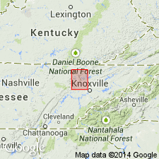
Wartburg sandstone [of Pottsville group]. Interbedded sandstones, sandy shales, argillaceous shales, and coal beds. Perhaps as much as half of formation is sandstone, the two beds at top and bottom being specially conspicuous. As many as 5 seams of coal occur with these strata. The sandstone beds vary in thickness from a few inches to 50 feet, and shale beds are of similar size. Thickness of formation 500 to 650 feet. Underlies Scott shale and overlies Briceville shale. [Age is Pennsylvanian.]
Named from town of Wartburg, Morgan Co., northeastern TN, which is situated upon this sandstone.
Source: US geologic names lexicon (USGS Bull. 896, p. 2277).

- Usage in publication:
-
- Wartburg sandstone
- Modifications:
-
- Overview
- AAPG geologic province:
-
- Appalachian basin
Summary:
According to L.C. Glenn (Tennessee Geol. Survey Bull., no. 33-B, p. 19, 310, 311, 1925) the sandstone upon which town of Wartburg is located is a bed, 30 to 40 feet thick, just below middle of Briceville shale and from a few feet to 30 or 40 feet beneath Poplar Creek coal. He therefore introduced new name Jelico formation for the rocks overlying Briceville shale and underlying Scott shale, and restricted the name Wartburg sandstone to the sandstone at Wartburg. [Age is Pennsylvanian.]
[See Wartburg sandstone member.]
Source: US geologic names lexicon (USGS Bull. 896, p. 2277).

- Usage in publication:
-
- Wartburg sandstone
- Modifications:
-
- Revised
- AAPG geologic province:
-
- Appalachian basin
Summary:
Pg. 5 (pl. 4), 6. Wartburg sandstone of Crooked Fork group. Reallocated to Crooked Fork group (new). Overlies Glenmary shale (new); underlies Poplar Creek coal at top of group. Age is Early Pennsylvanian (Pottsville).
Source: US geologic names lexicon (USGS Bull. 1200, p. 4135).

- Usage in publication:
-
- Wartburg Sandstone
- Modifications:
-
- Areal extent
- Dominant lithology:
-
- Sandstone
- AAPG geologic province:
-
- Appalachian basin
Summary:
(East-central sheet; not separately mapped.) Wartburg Sandstone of Crooked Fork Group. Gray to brown, fine- to medium-grained, locally conglomeratic sandstone. Includes Poplar Creek coal and thin shale at top. Thickness 0 to 50 feet. Top formation of Crooked Fork Group, above Glenmary Shale. Lies below Slatestone Formation. Age is Pennsylvanian.
Source: Publication.
For more information, please contact Nancy Stamm, Geologic Names Committee Secretary.
Asterisk (*) indicates published by U.S. Geological Survey authors.
"No current usage" (†) implies that a name has been abandoned or has fallen into disuse. Former usage and, if known, replacement name given in parentheses ( ).
Slash (/) indicates name conflicts with nomenclatural guidelines (CSN, 1933; ACSN, 1961, 1970; NACSN, 1983, 2005, 2021). May be explained within brackets ([ ]).