The National Geologic Map Database is migrating to a new infrastructure. We apologize for any service disruptions during this process.
|
|---|


- Usage in publication:
-
- Warren Formation
- Modifications:
-
- Named
- Geochronologic dating
- Dominant lithology:
-
- Andesite
- Basalt
- AAPG geologic province:
-
- Modoc Plateau province
- Great Basin province
Summary:
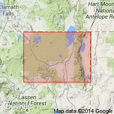
Most complete section occurs below summit of Warren Peak [Warren Peak 7.5' quad, Modoc Co, CA]. Here 7 flows are composed of 300-ft thick andesite flow succeeded by 6 thin basalt flows. Uppermost flow is diktytaxitic and gray in color and can be traced down to vicinity of US HWY 395; it does seem to be continuous from Warren Peak down to table land north of Likely, CA (probably an example of a flood basalt). This flow is the Warner basalt of Russell (1928). Flows of this nature were named "Mesa Basalt" by Merriam (1910). Duffield [personal commun.] reports whole-rock K-Ar age of about 5 Ma on flow. Age of unit in study area (Warner Mountains) given as Tertiary.
Source: GNU records (USGS DDS-6; Menlo GNULEX).
For more information, please contact Nancy Stamm, Geologic Names Committee Secretary.
Asterisk (*) indicates published by U.S. Geological Survey authors.
"No current usage" (†) implies that a name has been abandoned or has fallen into disuse. Former usage and, if known, replacement name given in parentheses ( ).
Slash (/) indicates name conflicts with nomenclatural guidelines (CSN, 1933; ACSN, 1961, 1970; NACSN, 1983, 2005, 2021). May be explained within brackets ([ ]).