The National Geologic Map Database is migrating to a new infrastructure. We apologize for any service disruptions during this process.
|
|---|


- Usage in publication:
-
- Warner basalt
- Modifications:
-
- Original reference
- Dominant lithology:
-
- Basalt
- AAPG geologic province:
-
- Modoc Plateau province
- Great Basin province
Summary:
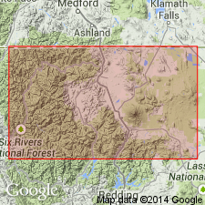
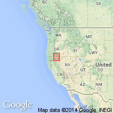
Pg. 418-425 and map. Warner basalt. A thin sheet of basaltic lava. The most widespread surface rock in Modoc County, northeastern California, probably covering half the county. Thickness 0 to 600 feet. In Virgin Valley, Merriam (1910) applied name Mesa basalt to portion of unit. May also be Merriam's Pueblo Range series. Underlies rhyolite. Overlies Cedarville series [new], the upper part of which contains flora considered to be Mascall (middle and upper Miocene). The Warner basalt is therefore considered much younger than Columbia River basalt. [Age is considered Tertiary.]
Named from exposures on sides of Warner Valley, and from widespread distribution in Warner Lakes Range [southeastern OR] and Warner Range [northeastern CA].
Source: U.S. geologic names lexicon (USGS Bull. 896, p. 2274); GNU records (USGS DDS-6; Menlo GNULEX).
- Usage in publication:
-
- Warner basalt
- Modifications:
-
- Age modified
- Areal extent
- AAPG geologic province:
-
- Modoc Plateau province
- Great Basin province
Summary:
Warner basalt is shown on geologic map of Modoc Lava-Bed 1 x 1 degree quadrangle. It also extends into Alturas quadrangle and north onto Oregon plateau, east of Cascade Range. Described as light-gray, equigranular, loose-textural rock with many honey-yellow olivine crystals and irregular grains of greenish pyroxene disseminated throughout feldspar matrix. Age is Pliocene and early Pleistocene.
Source: Modified from GNU records (USGS DDS-6; Menlo GNULEX).
- Usage in publication:
-
- Warner basalt
- Modifications:
-
- Areal extent
- AAPG geologic province:
-
- Modoc Plateau province
- Great Basin province
Summary:
Forms main capping of Hays Canyon range, northwestern Nevada, and at Pit River, northeastern California. Lies concordantly upon both Alturas and upper part of Cedarville formations. Age is Pliocene (post-Alturas).
Source: Modified from GNU records (USGS DDS-6; Menlo GNULEX).
- Usage in publication:
-
- Warner Basalt
- Modifications:
-
- Overview
- AAPG geologic province:
-
- Modoc Plateau province
- Great Basin province
Summary:
Name Warner Basalt of Russell (1928) retained as collective term for petrographically and structurally similar lavas throughout Modoc region without any specific implication as to contemporaneity. Largest continuous exposure of Warner Basalt is that of Gardens Basalt on high plateau commonly called The Gardens or The Devils Garden; total area of 700 sq mi.
Source: Modified from GNU records (USGS DDS-6; Menlo GNULEX).
- Usage in publication:
-
- Warner basalt
- Modifications:
-
- Geochronologic dating
- AAPG geologic province:
-
- Modoc Plateau province
Summary:
Warner Basalt is most widespread unit in Tennant area surrounding Tennant, California, Bray 15-min quadrangle. Upper flow (locally referred to as "Tennant basalt") has isotopic age of 0.53 +/-0.28 Ma. Lowermost flow in Lava Beds National Monument has isotopic age of 1.02 +/-0.55 Ma (citing Mertzman, 1977). Also in Medicine Lake Highland age of less than 100 ka has been determined by Mertzman (1977).
Source: Modified from GNU records (USGS DDS-6; Menlo GNULEX).
- Usage in publication:
-
- Warner Basalt
- Modifications:
-
- Not used
- AAPG geologic province:
-
- Modoc Plateau province
- Great Basin province
Summary:
Informal "basalt of Devils Garden" is used for lava field that lies between Basin-and-Range and Cascade Range physiographic provinces. Makes up much of poorly defined region called Modoc plateau (of Macdonald, 1966).
Source: Modified from GNU records (USGS DDS-6; Menlo GNULEX).
For more information, please contact Nancy Stamm, Geologic Names Committee Secretary.
Asterisk (*) indicates published by U.S. Geological Survey authors.
"No current usage" (†) implies that a name has been abandoned or has fallen into disuse. Former usage and, if known, replacement name given in parentheses ( ).
Slash (/) indicates name conflicts with nomenclatural guidelines (CSN, 1933; ACSN, 1961, 1970; NACSN, 1983, 2005, 2021). May be explained within brackets ([ ]).