The National Geologic Map Database is migrating to a new infrastructure. We apologize for any service disruptions during this process.
|
|---|


- Usage in publication:
-
- Warm Springs Tuff Member/
- Modifications:
-
- Named
- Dominant lithology:
-
- Tuff
- Sandstone
- AAPG geologic province:
-
- Modoc Plateau province
- Great Basin province
Summary:
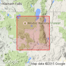
Pyroclastic rocks in Alturas basin, Modoc County, California, are herein named /Warm Springs Tuff Member of Alturas formation. Member is 100 to 400 feet thick sequence of gray to brown, massive pumice lapilli tuff, light-colored sandstone, and resistant rimrock areas. Includes numerous chimney rocks caused by weathering of massive ash-flow tuff. Overlies unnamed lower member; underlies unnamed basalt member, both of Alturas formation. Age is Pliocene and Pleistocene [basis for age assignment not stated.]
[Name preempted by Warm Springs Formation of Lupher (1941) in OR.]
Source: Modified from GNU records (USGS DDS-6; Menlo GNULEX).
For more information, please contact Nancy Stamm, Geologic Names Committee Secretary.
Asterisk (*) indicates published by U.S. Geological Survey authors.
"No current usage" (†) implies that a name has been abandoned or has fallen into disuse. Former usage and, if known, replacement name given in parentheses ( ).
Slash (/) indicates name conflicts with nomenclatural guidelines (CSN, 1933; ACSN, 1961, 1970; NACSN, 1983, 2005, 2021). May be explained within brackets ([ ]).