The National Geologic Map Database is migrating to a new infrastructure. We apologize for any service disruptions during this process.
|
|---|


- Usage in publication:
-
- Warm Springs formation
- Modifications:
-
- Named
- Dominant lithology:
-
- Sandstone
- Shale
- Mudstone
- AAPG geologic province:
-
- Snake River basin
Summary:
Pg. 227 (table 1), 229-249. Warm Springs formation. Sandstone, shale, and mudstone gradation in upper part of Colpitts group (new). Thickness ranges from 100 to 300 feet. Overlies Weberg formation (new) of Colpitts group; contact not sharply defined. Unconformably underlies Hyde formation (new) of Izee group. Age is early Middle Jurassic, based on sonninid ammonites.
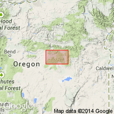
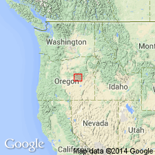
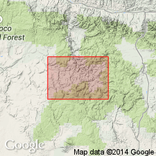
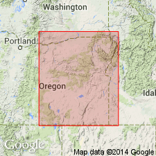
Type area: exposures on east side of Warm Springs Creek Valley, in secs. 19, 20, 29, and 30, T. 18 S., R. 26 E., [Grant Co.?], OR. Named from Warm Springs Creek, Crook Co., east-central OR.
Source: US geologic names lexicon (USGS Bull. 1200, p. 4128); supplemental information from GNU records (USGS DDS-6; Menlo GNULEX).
- Usage in publication:
-
- Warm Springs formation
- Modifications:
-
- Areal extent
- AAPG geologic province:
-
- Snake River basin
Summary:
Weberg, Warm Springs, and Basey (new) formations are lateral equivalents of Snowshoe formation.
Source: US geologic names lexicon (USGS Bull. 1200, p. 4128).
- Usage in publication:
-
- Warm Springs Member
- Modifications:
-
- Revised
- Biostratigraphic dating
- AAPG geologic province:
-
- Snake River basin
Summary:
Warm Springs Formation of Lupher (1941) is reduced in rank and assigned to Snowshoe Formation as 2nd from lowermost member (of 4). Shown on geologic map of Suplee-Izee area. Conformably overlies Weberg Member of Snowshoe Formation; where Weberg is absent, unconformably overlies Mowich Group. Conformably underlies Basey Member of Snowshoe Formation. Ammonites suggest correlation with upper part of SONNINIA SOWERBYI Zone and lower part of OTOITES SAUZEI Zone of middle Bajocian (citing R.W. Imlay, written commun., 1963).
Source: Modified from GNU records (USGS DDS-6; Menlo GNULEX).
- Usage in publication:
-
- Warm Springs Member
- Modifications:
-
- Overview
- AAPG geologic province:
-
- Snake River basin
Summary:
Pg. 55-56. Warm Springs Member of Snowshoe Formation. Lupher (1941) proposed Warm Springs Formation of Colpitts Group; designated type area as exposures on east side of Warm Springs Creek Valley, in secs. 19, 20, 29, and 30, T. 18 S., R. 26 E. Dickinson and Vigrass (1965) revised the Warm Springs to 1 of 4 members of Snowshoe Formation (considered it a lateral equivalent of part of lower Snowshoe to the east). Is exposed as narrow bands along limbs of major structures in the Suplee district, including nose of Mowich anticline and limbs of Pine Creek downwarp situated immediately to the northwest. Consists of 200 to 300 feet of dark, silty, calcareous shale and mudstone with subordinate amounts of intercalated gray calcareous siltstone and fine-grained limestone. With the exception of fine laminations in the type area, the unit is indistinctly bedded. Conformably overlies Weberg Member of Snowshoe Formation (distinguished from Weberg by finer grain size and lower lime content); where Weberg is not present, unconformably overlies older units. Conformably underlies Basey Member of Snowshoe Formation. Age is Middle Jurassic (early middle Bajocian).
See also Dickinson, W.R., and Vigrass, L.W., 1965, "Geology of the Suplee-Izee area, Cook, Grant, and Harney Counties, Oregon," Oregon Dept. Geol. and Min. Ind. Bull., no. 58, 109 p., geol. map (scale 1:42,000).
Source: Publication.
- Usage in publication:
-
- Warm Springs Member*
- Modifications:
-
- Biostratigraphic dating
- Adopted
- AAPG geologic province:
-
- Snake River basin
Summary:
Warm Springs Member of Snowshoe Formation. Warm Springs Member [of Dickinson and Vigrass (1965)] is adopted by the USGS as middle of 3 members of Snowshoe Formation in Suplee area, eastern Oregon. Overlies and intertongues with Weberg Member of Snowshoe; underlies Basey Member of Snowshoe. Age is Middle Jurassic. Report includes detailed faunal lists, descriptions, map locations of Bajocian ammonites.
[Misprint: USGS Bull. 1395-A (p. A45) indicates USGS adopted Warm Springs Member of Lupher (1941); is Warm Springs Member of Dickinson and Vigrass (1965).]
Source: Changes in stratigraphic nomenclature, 1973 (USGS Bull. 1395-A, p. A44-A45); supplemental information from GNU records (USGS DDS-6; Menlo GNULEX).
For more information, please contact Nancy Stamm, Geologic Names Committee Secretary.
Asterisk (*) indicates published by U.S. Geological Survey authors.
"No current usage" (†) implies that a name has been abandoned or has fallen into disuse. Former usage and, if known, replacement name given in parentheses ( ).
Slash (/) indicates name conflicts with nomenclatural guidelines (CSN, 1933; ACSN, 1961, 1970; NACSN, 1983, 2005, 2021). May be explained within brackets ([ ]).