The National Geologic Map Database is migrating to a new infrastructure. We apologize for any service disruptions during this process.
|
|---|


- Usage in publication:
-
- Wapshilla Ridge unit
- Modifications:
-
- [Informally named]
- AAPG geologic province:
-
- Eastern Columbia basin
Summary:
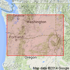
Pg. 23 (fig. 1), 40 (table 2), 48-49. Wapshilla Ridge unit (informal) in Grande Ronde Basalt of Columbia River Basalt Group. Is most voluminous unit in the Grande Ronde Basalt. Consists of 28+ flows; glassy to fine-grained, plagioclase-microphyric, displays entablature/colonnade jointing in western exposures and blocky/columnar jointing in eastern exposures. Has reversed magnetic polarity (in R2 magnetostratigraphic unit). Lies above Mt. Horrible unit (informal) and below Grouse Creek unit (informal); both in Grande Ronde Basalt. Age is early Miocene.
Named from excelllent exposures on Wapshilla Ridge, which forms the divide btw. Snake and Salmon Rivers, [Nez Perce Co.], ID.
Reference localities: (1) Wapshilla Ridge, near confluence of Snake and Salmon Rivers, in secs. 2, 3, 11, and 12, T. 30 N., R. 4 W., Wapshilla Creek 7.5-min quadrangle, [Nez Perce Co.], ID; (2) Grande Ronde Basalt type locality, prominent west-trending spur ridge, extending from NW/4 sec. 23 across N/3 sec. 22 to NE/4 sec. 21, T. 7 N., R. 46 E., Black Butte quadrangle, in the lower part of Grande Ronde River Valley, Asotin Co., extreme southeast WA; and (3) Multnomah Falls, in sec. 18, T. 1 N., R. 6 E., Multnomah Falls 7.5-min quadrangle, [Multnomah Co., northern OR].
Source: Publication.
For more information, please contact Nancy Stamm, Geologic Names Committee Secretary.
Asterisk (*) indicates published by U.S. Geological Survey authors.
"No current usage" (†) implies that a name has been abandoned or has fallen into disuse. Former usage and, if known, replacement name given in parentheses ( ).
Slash (/) indicates name conflicts with nomenclatural guidelines (CSN, 1933; ACSN, 1961, 1970; NACSN, 1983, 2005, 2021). May be explained within brackets ([ ]).