- Usage in publication:
-
- Wapsaconhagan Brook Group
- Modifications:
-
- Named
- Dominant lithology:
-
- Volcaniclastics
- Mudstone
- AAPG geologic province:
-
- New England province
Summary:
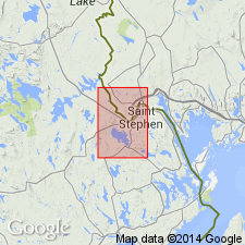
Wapsaconhagan Brook Group [informally] named from brook where excellent outcrops of all but the lowest formation are exposed in its drainage basin in the Calais quad., Washington Co., ME. These rocks were first mapped as the Dark Argillite Division of the Charlotte Group (Alcock, 1946; Amos, 1963) and later as informal members of the Cookson Formation (Ruitenberg and Ludman, 1978; Ludman, 1985). Total exposed thickness of unit is greater than 3000 m, but estimate is made difficult by extensive folding, faulting, and intrusions. Group is readily mappable into the following four formations (ascending): Pocomoonshine Lake (Cambrian, 200 m), Kendall Mountain (Cambrian, 500-800 m), Woodland (Cambrian, 1000 m), all new [informal] names, and Cookson (Ordovician, 1000 m), extensively restricted in study area. All of these are sulfidic and rusty weathering, with carbonaceous pelite, coticule, and pillow basalt. Rocks correlate, for the most part, with those of the St. John Group of southeastern New Brunswick, CAN. In the Calais area, group unconformably underlies the Silurian Oak Bay Formation; elsewhere unconformably underlies the Silurian Digdeguash Formation. Overlies undifferentiated sedimentary rock. Earliest Ordovician (Tremadocian) age of the youngest formation within the group based on graptolites. Assignment of Cambrian age to the lower formations based on stratigraphic position below the Cookson.
Source: GNU records (USGS DDS-6; Reston GNULEX).
For more information, please contact Nancy Stamm, Geologic Names Committee Secretary.
Asterisk (*) indicates published by U.S. Geological Survey authors.
"No current usage" (†) implies that a name has been abandoned or has fallen into disuse. Former usage and, if known, replacement name given in parentheses ( ).
Slash (/) indicates name conflicts with nomenclatural guidelines (CSN, 1933; ACSN, 1961, 1970; NACSN, 1983, 2005, 2021). May be explained within brackets ([ ]).

