

- Usage in publication:
-
- Wapiti Formation*
- Modifications:
-
- Named
- Dominant lithology:
-
- Breccia
- Sandstone
- Siltstone
- Conglomerate
- AAPG geologic province:
-
- Bighorn basin
Summary:
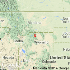
Named for exposures between about 8,800 and 10,300 ft altitude in mountains north and south of Wapiti PO about 18 mi west of Cody, Park Co, WY in Bighorn basin. The section north of the PO is designated the type section. Is composed of volcanic breccia, sandstone, siltstone, conglomerate, and lava. These different rock types range from a few ft to a few hundreds of ft in thickness, and are interbedded with other rock types. The breccia is somber shades of brown and gray, poorly sorted with pyroclastic and other volcanic material. The breccia is thought to be in part an alluvial and in part a mudflow deposit. The sandstone, siltstone, and conglomerate consist of medium-brown and gray pyroclastic material, volcanic breccia, and fragments of lava flows, as well as quartz and quartzite. Lava flows occur, singly or in sequences. A prominent sequence named Jim Mountain Member occurs near the middle. Is 3,800 ft thick in north part of area and 1,700 ft thick in south part. Overlies Willwood Formation; underlies Trout Peak Trachyandesite (new). Fossil plants indicate a probable middle Eocene age, or a late early or early middle Eocene age. Is assigned an early or middle Eocene age, or both. Is equivalent to Pitchfork Formation, but name Pitchfork should be restricted to breccia-poor rocks south of report area.
Source: GNU records (USGS DDS-6; Denver GNULEX).
- Usage in publication:
-
- Wapiti Formation*
- Modifications:
-
- Revised
- Areal extent
- AAPG geologic province:
-
- Yellowstone province
- Bighorn basin
Summary:
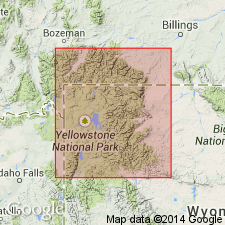
Assigned to Sunlight Group (new) of Absaroka Volcanic Supergroup (new). Is equivalent to the early basic breccia of earlier reports. Mapped into Yellowstone National Park from Bighorn basin. Its finer grained equivalent to southeast along the South Fork Shoshone River is Pitchfork Formation. Is as much as 5,000 ft thick in the Crandall-Sunlight area. Overlies Willwood Formation at type but to northwest overlies Lamar River Formation (new) or Cathedral Cliffs Formation of Sunlight Group of Absaroka Volcanic Supergroup. Underlies unconformably, and locally interfingers with, Trout Peak Trachyandesite. Is of middle Eocene age.
Source: GNU records (USGS DDS-6; Denver GNULEX).
- Usage in publication:
-
- Wapiti Formation
- Modifications:
-
- Areal extent
- AAPG geologic province:
-
- Bighorn basin
Summary:
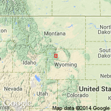
Wapiti and Aycross Formations are lateral and time equivalents. The geographic boundary is in the Francs Fork Timber Creek area in the Absaroka Range. Wapiti used to north and Aycross to south. In area of Carter Mountain, Ptarmigan Mountain, and Jim Mountain, Aycross-like beds mapped in Wapiti. Replaces use of Pitchfork Formation (abandoned) on Carter and Ptarmigan Mountains, southeastern Absaroka Range, Park Co, WY in the Bighorn basin. Unconformably overlies Willwood Formation. Underlies Trout Peak Trachyandesite on Jim Mountain. Underlies unnamed sequence on Ptarmigan and Carter Mountains. Eocene age.
Source: GNU records (USGS DDS-6; Denver GNULEX).
- Usage in publication:
-
- Wapiti Formation
- Modifications:
-
- Not used
Summary:
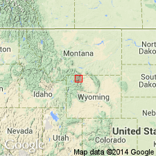
[Established formal nomenclature is not used in Park Co, WY.] "Due to the fact that the formal nomenclature of volcanic rocks of the Northern Absaroka Mountains has proven problematical in field mapping of the detachment area (Fig 2), and because the names "Wapiti Formation" and "Cathedral Cliffs Formation" both connote temporal relationships with Heart Mountain faulting that are unresolved, the formal nomenclature was abandoned in this study." [Choice of word "abandoned" is unfortunate. Author should simply have said that he was "not using" the established formal nomenclature in his study area.]
Source: GNU records (USGS DDS-6; Denver GNULEX).
For more information, please contact Nancy Stamm, Geologic Names Committee Secretary.
Asterisk (*) indicates published by U.S. Geological Survey authors.
"No current usage" (†) implies that a name has been abandoned or has fallen into disuse. Former usage and, if known, replacement name given in parentheses ( ).
Slash (/) indicates name conflicts with nomenclatural guidelines (CSN, 1933; ACSN, 1961, 1970; NACSN, 1983, 2005, 2021). May be explained within brackets ([ ]).