

- Usage in publication:
-
- Wanrhodes volcanics
- Modifications:
-
- First used
- Dominant lithology:
-
- Tuff
- AAPG geologic province:
-
- Wasatch uplift
Summary:
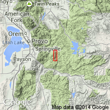
First? published use of name. [Intent to name, location of geographic name, designation of a type not stated, contacts, regional extent, contacts not stated.] Consists of a series of water-laid tuffs that are exposed on the northwest flank of the Diamond Fork anticline in T8S, R5E, Utah Co, UT on the Wasatch uplift. The tuffs are light-gray, medium[-grained?] to conglomeratic, and fairly well bedded. May be equivalent to some volcanics farther north that have been assigned an Oligocene age on basis of vertebrate fossils. Underlying unit is probably the Eocene Uinta formation. Shown as the youngest unit on a cross section.
Source: GNU records (USGS DDS-6; Denver GNULEX).
- Usage in publication:
-
- Wanrhodes Volcanics*
- Modifications:
-
- Overview
- AAPG geologic province:
-
- Wasatch uplift
Summary:
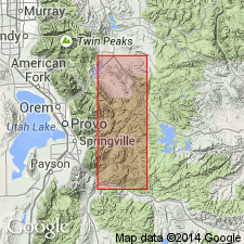
In the trough of a syncline along Wanrhodes Canyon and on Billies Mountain south of Diamond Fork in T9S, Rs 4 and 5E, T8S, R4E in southwest part of quad, Utah Co, UT on the Wasatch uplift. These localities are designated the type locality. Consists of gray, medium- to coarse-grained, friable bedded tuffs about 500 ft thick. Lenses and beds of conglomeratic rubble containing boulders up to 2+ ft in diameter also present. These boulders are of quartzite, sandstone, limestone, chert and igneous rocks. Thought to be the northern extension of the Maroni Formation tentatively assigned to the Miocene. Overlies Uinta? Formation. Age not definitely determined. Assigned to the Oligocene on the basis of correlation with other tuffs in region. Belongs to the period of volcanism in this area that extended from late Eocene to early Miocene.
Source: GNU records (USGS DDS-6; Denver GNULEX).
For more information, please contact Nancy Stamm, Geologic Names Committee Secretary.
Asterisk (*) indicates published by U.S. Geological Survey authors.
"No current usage" (†) implies that a name has been abandoned or has fallen into disuse. Former usage and, if known, replacement name given in parentheses ( ).
Slash (/) indicates name conflicts with nomenclatural guidelines (CSN, 1933; ACSN, 1961, 1970; NACSN, 1983, 2005, 2021). May be explained within brackets ([ ]).