The National Geologic Map Database is migrating to a new infrastructure. We apologize for any service disruptions during this process.
|
|---|


- Usage in publication:
-
- Wamsutter Rim coal bed*
- Modifications:
-
- Named
- Dominant lithology:
-
- Coal
- AAPG geologic province:
-
- Green River basin
Summary:
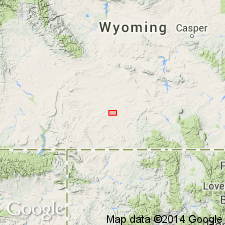
Named as an informal coal bed in upper part of Niland Tongue (revised) of Wasatch Formation. Unit is lenticular in outcrops that extend for nearly 10 mi along Wamsutter Rim, for which it is named, from sec. 22, T19N, R95W, to sec 22, T19N, R94W, Sweetwater Co, WY, Greater Green River basin. Coal is clean and shiny with conchoidal fracture and a very light specific gravity. Unit is high-quality canneloid coal suitable for underground mining. Coal has an estimated heating value of 11,500 Btu/lb. Table 1 shows proximate analysis; table 2 shows maceral varieties. Thickness ranges from 4.7-7.6 ft; wedges out in eastern part of study area. Occurs between slopes of overlying Scheggs Bed of Tipton Shale Member of Green River Formation and underlying interbedded sandstone, shale, and oil shale in Niland Tongue of Wasatch. Measured sections; cross section; generalized restored cross section. Previously included in "Black Rock coal group" of Schultz (1920, USGS Bull. 702); described by Bradley (1945, USGS Oil and Gas Invest. Prelim. Map 32); within "upper coal group" of Pipiringos (1961, USGS Bull. 1099-A). Correlates with Vermilion Creek coal bed in southwest part of Washakie basin. Coal was deposited in peat bog in backshore area of Eocene Lake Gosiute. Assigned late early Eocene age based on fossil mammals collected by other workers at sites outside study area and at various stratigraphic levels.
Source: GNU records (USGS DDS-6; Denver GNULEX).
For more information, please contact Nancy Stamm, Geologic Names Committee Secretary.
Asterisk (*) indicates published by U.S. Geological Survey authors.
"No current usage" (†) implies that a name has been abandoned or has fallen into disuse. Former usage and, if known, replacement name given in parentheses ( ).
Slash (/) indicates name conflicts with nomenclatural guidelines (CSN, 1933; ACSN, 1961, 1970; NACSN, 1983, 2005, 2021). May be explained within brackets ([ ]).