The National Geologic Map Database is migrating to a new infrastructure. We apologize for any service disruptions during this process.
|
|---|


- Usage in publication:
-
- Wamsutta Formation*
- Modifications:
-
- Overview
- AAPG geologic province:
-
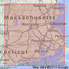
- New England province
Summary:
Authors use Wamsutta Formation. Consists of red to pink, well-sorted conglomerate, graywacke, sandstone, and shale with fossil plants. Includes separately mapped rhyolite and mafic volcanic rocks mapped within Wamsutta. Age is Early and Middle Pennsylvanian.
Source: GNU records (USGS DDS-6; Reston GNULEX).
- Usage in publication:
-
- Wamsutta Formation
- Modifications:
-
- Revised
- Overview
- Biostratigraphic dating
- Dominant lithology:
-
- Conglomerate
- AAPG geologic province:
-
- New England province
Summary:
Author here assigns the Sachuest Arkose, Purgatory Conglomerate, Pondville Conglomerate, Wamsutta Formation, Rhode Island Formation, and Dighton Conglomerate to the Rhode Island Group of northern Rhode Island and southeastern Massachusetts. Wamsutta described as interbedded red, coarse-grained conglomerate, some felsite, lithic graywacke, sandstone, and shale. Contains a few lenses of limestone and one flow of red rhyolite and several sheets of altered mafic volcanics. Thickness is 595 m. Interfingers with Pondville Conglomerate and Rhode Island Formation. Occurs in Norfolk basin and northern Narragansett basin. Unit ranges from Westphalian A(?) to Westphalian C (Early to Middle Pennsylvanian), based on megaflora and microfauna. .
[Usage of the Rhode Island in this report is not recommended. According to Article 19f of the NACSN code (1983), "In changing the rank of a unit, the same name may not be applied both to the unit as a whole and to a part of it."]
Source: GNU records (USGS DDS-6; Reston GNULEX).
- Usage in publication:
-
- Wamsutta Formation*
- Modifications:
-
- Overview
- AAPG geologic province:
-
- New England province
Summary:
Wamsutta Formation occurs in Narragansett and Norfolk basins. Consists of conglomerate, lithic graywacke, sandstone, and shale. Also contains rhyolite and basalt horizons near Attleboro. Northwest of Attleboro, Wamsutta overlies Diamond Hill Felsite as used by Skehan and Murray (in Skehan and others, 1979). Volcanic rocks similar to Diamond Hill Felsite crop out west of Lake Pearl, between Franklin and Wrentham, on west flank of Norfolk basin. These are shown within Wamsutta Formation on the MA State bedrock map of Zen and others (1983) because of their proximity to Diamond Hill. They also resemble Proterozoic Z Mattapan Volcanic Complex. Chute (1966) described lenses of carbonate rock in red and green shale in Wamsutta in Norwood quadrangle. Limestone also observed in rocks mapped as Wamsutta adjacent to exposed Dedham Granite at Manchester Pond Reservoir (J.P. Schafer, 1982, oral commun.). Red and green shales may actually be Cambrian. Upper member of Pondville Conglomerate grades into and interfingers with Wamsutta; in turn, Wamsutta interfingers with Rhode Island Formation in northwest part of Narragansett basin. Nonconformably overlies Dedham Granite. Partly equivalent to Rhode Island Formation. Age is Early and Middle Pennsylvanian. Contains a few plant fossils. Report includes geologic maps, correlation charts. [Chapters A-J in U.S. Geological Survey Professional Paper 1366 are intended as explanations and (or) revisions to the 1:250,000-scale MA State bedrock geologic map of Zen and others (1983).]
Source: GNU records (USGS DDS-6; Reston GNULEX).
For more information, please contact Nancy Stamm, Geologic Names Committee Secretary.
Asterisk (*) indicates published by U.S. Geological Survey authors.
"No current usage" (†) implies that a name has been abandoned or has fallen into disuse. Former usage and, if known, replacement name given in parentheses ( ).
Slash (/) indicates name conflicts with nomenclatural guidelines (CSN, 1933; ACSN, 1961, 1970; NACSN, 1983, 2005, 2021). May be explained within brackets ([ ]).