

- Usage in publication:
-
- Waltman Shale Member*
- Modifications:
-
- Named
- Dominant lithology:
-
- Claystone
- Shale
- Sandstone
- Coal
- AAPG geologic province:
-
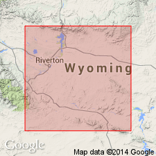
- Wind River basin
Summary:
Named as lower of two members of upper part of Fort Union Formation for town of Waltman in northwest Natrona Co, WY. Type section designated in S1/2 sec 8 and NE1/4 sec 17, T36N, R86W, Natrona Co, Wind River basin. Outcrops in narrow northwest-trending belt northeast of Waltman where beds are vertical to overturned and are part of west flank of Casper arch. Unit is widespread in subsurface, extending over several hundred square miles in basin. At type unit is 643 ft thick and consists of chocolate-brown and gray silty and shaly claystone interbedded with a few thin beds of ledge-forming sandstone; claystone contains abundant minute white mica flakes. In subsurface thickness ranges from wedge-edge along southern and western margins of basin to 2580 ft along northern margin. In subsurface consists of dark-brown to black shale interbedded with sandstone; shale contains scattered thread-like streaks of coal. At outcrop base of unit is in fault contact with lower Eocene rocks and in angular discordance with overlying lower Eocene rocks. In subsurface, overlies lower part of Fort Union; underlies and interfingers with Shotgun Member (new) of Fort Union. Measured sections. Cross sections. Electric log characteristics. Deposited in offshore marine environment. Preliminary studies of pollen assemblages indicate middle to late Paleocene age.
Source: GNU records (USGS DDS-6; Denver GNULEX).
For more information, please contact Nancy Stamm, Geologic Names Committee Secretary.
Asterisk (*) indicates published by U.S. Geological Survey authors.
"No current usage" (†) implies that a name has been abandoned or has fallen into disuse. Former usage and, if known, replacement name given in parentheses ( ).
Slash (/) indicates name conflicts with nomenclatural guidelines (CSN, 1933; ACSN, 1961, 1970; NACSN, 1983, 2005, 2021). May be explained within brackets ([ ]).