The National Geologic Map Database is migrating to a new infrastructure. We apologize for any service disruptions during this process.
|
|---|


- Usage in publication:
-
- Wall Lake Latite
- Modifications:
-
- Original reference
- AAPG geologic province:
-
- Basin-and-Range province
Summary:
Pg. 234, 238. Wall Lake Latite. Overlies Deadwood Gulch Rhyolite; underlies Bearwallow Mountain Formation. Age is Miocene.
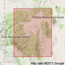
Type locality not stated. Named from Wall Lake south of [Beaverhead ranger station, Gila National Forest, in sec. 10, T. 11 S., R. 12 W., Wall Lake 7.5-min quadrangle, Catron Co.], Mogollon Plateau, central western NM.
[Misprint (US geologic names lexicon, USGS Bull. 1520, p. 327): Wall Lake is in Catron Co., not Grant Co.]
Source: US geologic names lexicon (USGS Bull. 1520, p. 327).
For more information, please contact Nancy Stamm, Geologic Names Committee Secretary.
Asterisk (*) indicates published by U.S. Geological Survey authors.
"No current usage" (†) implies that a name has been abandoned or has fallen into disuse. Former usage and, if known, replacement name given in parentheses ( ).
Slash (/) indicates name conflicts with nomenclatural guidelines (CSN, 1933; ACSN, 1961, 1970; NACSN, 1983, 2005, 2021). May be explained within brackets ([ ]).