

- Usage in publication:
-
- Waimanalo Formation
- Modifications:
-
- Named
- Dominant lithology:
-
- Limestone
- AAPG geologic province:
-
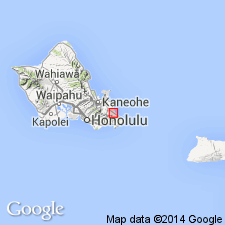
- Oahu
Summary:
Named for reef and associated limestone deposit and undifferentiated lagoonal-deltaic sediments deposited during Waimanalo stand of sea, southeast part of Island of Oahu. [Type locality not stated] Consists of cream to grayish-white reef (37 ft) deposit of coral, coralline algae, mollusk shells, Foraminifera, and other reef-building organisms; lagoonal-deltaic facies (40 ft) consist of light-gray, fine, calcareous sand containing basaltic grains. Unconformably overlies Bellows Formation (new). Unconformably underlies deposits of late Pleistocene age. Assigned Pleistocene age based on Transgression III (Sangamon).
Source: GNU records (USGS DDS-6; Menlo GNULEX).
- Usage in publication:
-
- Waimanalo Formation
- Modifications:
-
- Age modified
- AAPG geologic province:
-
- Oahu
Summary:
Deposition of unit estimated at 400,000(?) to 125,000 yr B.P. T.L. Ku of USC collected coral in a position of growth from Waimanalo reef one ft above sea level which was determined to have an age of 137,000 +/-11,000 yr B.P.
Source: GNU records (USGS DDS-6; Menlo GNULEX).
For more information, please contact Nancy Stamm, Geologic Names Committee Secretary.
Asterisk (*) indicates published by U.S. Geological Survey authors.
"No current usage" (†) implies that a name has been abandoned or has fallen into disuse. Former usage and, if known, replacement name given in parentheses ( ).
Slash (/) indicates name conflicts with nomenclatural guidelines (CSN, 1933; ACSN, 1961, 1970; NACSN, 1983, 2005, 2021). May be explained within brackets ([ ]).