

- Usage in publication:
-
- Wahmonie Formation*
- Modifications:
-
- Named
- Geochronologic dating
- Dominant lithology:
-
- Tuff
- Sandstone
- Breccia
- Rhyodacite
- Dacite
- AAPG geologic province:
-
- Great Basin province
Summary:
Pg. A36-A44. Wahmonie Formation. A sequence of lava flows, tuff, tuff-breccia, conglomerate, and lithic tuff-breccia. Divided into 5 informal units (ascending): unit 1, rhyodacite flows, 100+ feet; unit 2, interbedded tuff, sandstone, lithic tuff-breccia, and pumice agglomerate, 1,700 feet; unit 3, lithic breccia, 270 feet; unit 4, conglomerate or lithic tuff breccia, 50 feet; and unit 5, rhyodacitic to dacitic lava flows and thin interflow tuffs and breccias, 3,500+ feet. Maximum exposed thickness about 3,500 feet. Original volume of at least 25 cubic miles. Overlies Salyer Formation (new). On Skull Mountain underlies Topopah Spring Member of Paintbrush Tuff. Northwest of Wahmonie Flat a late flow of the Wahmonie occurs between Topopah Spring and Tiva Canyon Members of the Paintbrush. Locally intertongues with part of the Salyer. Age is late Miocene and early Pliocene(?); yielded K-Ar ages of 12.9 +/-0.5 Ma (lower part) and 12.5 +/-0.5 Ma (upper part) (R.W. Kistler, written commun., 1963). Report includes measured section.
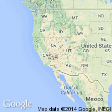
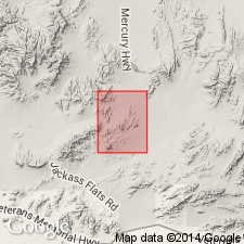
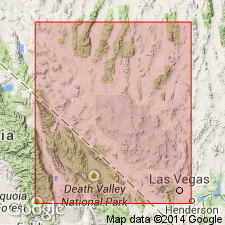
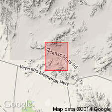
Type section: composite of partial sections on east and south sides of Wahmonie Flat, at Mount Salyer, and in area between Cane Spring and Hampel Hill, Nevada Test Site, Nye Co., southwestern NV. Unit 1, a small exposure on low ridge about 1.25 mi northwest of Cane Spring; unit 2, on northeast-trending ridge about 0.5 mi southeast of Cane Spring and around Hampel Hill; unit 3, at Mount Salyer; unit 4, on northwest side of Hampel Hill; unit 5, incomplete sections at east end of Wahmonie Flat and on north side of Skull Mountain. Covers area of little more than 500 sq mi. Named from Wahmonie Flat, Skull Mountain and Cane Spring quadrangles, Nevada Test Site, Nye Co., southwestern NV.
Source: Publication; US geologic names lexicon (USGS Bull. 1350, p. 802).
- Usage in publication:
-
- Wahmonie Formation*
- Modifications:
-
- Mapped
- AAPG geologic province:
-
- Great Basin province
Summary:
Age is Miocene and Pliocene(?) in mapped area. Six lithologic sub-units shown.
Source: GNU records (USGS DDS-6; Menlo GNULEX).
- Usage in publication:
-
- Wahmonie Formation*
- Modifications:
-
- Geochronologic dating
- AAPG geologic province:
-
- Great Basin province
Summary:
K-Ar ages of 12.9 Ma on biotite from ash fall and 12.5 Ma on biotite from rhyodacite lava from Wahmonie Formation are given. Sketch map shows samples collected approximately 33 mi east of Beatty NV. Age is Miocene (Barstovian, North American provincial age).
Source: GNU records (USGS DDS-6; Menlo GNULEX).
- Usage in publication:
-
- Wahmonie Formation*
- Modifications:
-
- Mapped
- AAPG geologic province:
-
- Great Basin province
Summary:
Age shown as Miocene. Is equivalent to interbedded tuff, sandstone, breccia, and agglomerate in Cane Springs quad (Twtb) of Poole and others (1965) and lithic tuff of middle part of (Twml) in Skull Mountain quad of Ekren and Sargent (1965).
Source: GNU records (USGS DDS-6; Menlo GNULEX).

- Usage in publication:
-
- Wahmonie Formation*
- Modifications:
-
- Revised
- Geochronologic dating
- AAPG geologic province:
-
- Great Basin province
Summary:
Revised in that Wahmonie older than newly named Calico Hills Formation; younger than Prow Pass Tuff of Crater Flat Group (both ranks raised). 40Ar/39Ar date on biotite yielded an age of 13.0 +/-0.10 Ma (Miocene).
Source: GNU records (USGS DDS-6; Denver GNULEX).
For more information, please contact Nancy Stamm, Geologic Names Committee Secretary.
Asterisk (*) indicates published by U.S. Geological Survey authors.
"No current usage" (†) implies that a name has been abandoned or has fallen into disuse. Former usage and, if known, replacement name given in parentheses ( ).
Slash (/) indicates name conflicts with nomenclatural guidelines (CSN, 1933; ACSN, 1961, 1970; NACSN, 1983, 2005, 2021). May be explained within brackets ([ ]).