The National Geologic Map Database is migrating to a new infrastructure. We apologize for any service disruptions during this process.
|
|---|


- Usage in publication:
-
- Wahlstrom Hollow Formation*
- Modifications:
-
- Named
- Dominant lithology:
-
- Limestone
- Siltstone
- AAPG geologic province:
-
- Great Basin province
Summary:
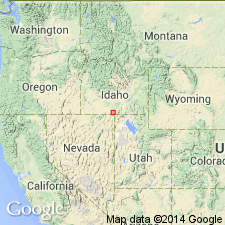
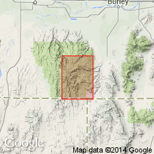
Named for exposures near Wahlstrom Hollow. Type section measured (graphic column) in NE1/4 SW1/4 NE1/4 sec 32, T13S, R19E (base) on a NE-SW trending ridge about 5.2 m above Third Fork along strike to southeast toward Wahlstrom Hollow, and ends in saddle in SW1/4 NE1/4 SW1/4 sec 32, T13S, R19E, Cassia Co, ID, Great Basin province. Exposed in deep valleys and at higher elevations in upthrown blocks, central and northeastern Cassia Mountains. Base covered. Overlain by Third Fork Formation (new). Consists of light- to dark-gray or brown to reddish, fine-grained, medium- to thick-bedded, fossiliferous, silty limestone and calcareous siltstone. Weathers to dark gray or buff. Pyrite common. Spicules common. Grayish-orange to grayish-brown weathering subspherical to elliptical siliceous nodules aligned parallel to bedding. Zones of discontinuous beds interpreted as subaqueous soft-sediment slumps. Other structures include graded lamination, microripples, cross lamination, convolute lamination, scoured surfaces, load structures. Turbidity deposit. Deposited under dysaerobic deep-water conditions. Gradual shallowing at end of Wahlstrom Hollow time. Of late Wolfcampian, Early Permian age. NEOGONDOLELLA BISSELLI occurs in middle.
Source: GNU records (USGS DDS-6; Denver GNULEX).
- Usage in publication:
-
- Wahlstrom Hollow Formation*
- Modifications:
-
- Overview
- AAPG geologic province:
-
- Great Basin province
Summary:
Is the oldest unit mapped in this quad in the Great Basin province. Occurs in the northwest part of quad beneath the Early Permian Third Fork Formation. The upper contact is gradational. Upper part forms steep slopes and broken ledges; lower part forms irregular scraggly cliffs. Is about 500 m thick. Of Early Permian age. [See also Stricker 1 quadrangle.]
Source: GNU records (USGS DDS-6; Denver GNULEX).
For more information, please contact Nancy Stamm, Geologic Names Committee Secretary.
Asterisk (*) indicates published by U.S. Geological Survey authors.
"No current usage" (†) implies that a name has been abandoned or has fallen into disuse. Former usage and, if known, replacement name given in parentheses ( ).
Slash (/) indicates name conflicts with nomenclatural guidelines (CSN, 1933; ACSN, 1961, 1970; NACSN, 1983, 2005, 2021). May be explained within brackets ([ ]).