

- Usage in publication:
-
- Wah Wah Springs tuff [member]
- Modifications:
-
- Named
- Dominant lithology:
-
- Tuff
- AAPG geologic province:
-
- Great Basin province
Summary:
Named as the lower of two members of the Needles Range Formation (new) for its occurrence south of Wah Wah Springs 15 mi west of abandoned town of Frisco, Beaver Co, UT in the Great Basin province. These exposures are designated the type locality. Grades from black vitrophyre at base to a light-gray nonwelded ashy top. Is 700 to 800 ft thick. Overlies Claron formation. Underlies Minersville tuff [member] (new). Of Eocene or Oligocene age.
Source: GNU records (USGS DDS-6; Denver GNULEX).
- Usage in publication:
-
- Wah Wah Springs Tuff Member
- Modifications:
-
- Contact revised
- Overview
- AAPG geologic province:
-
- Great Basin province
Summary:
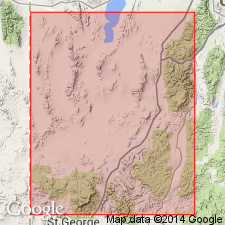
Is one of four members assigned to Needles Range Formation. Lower contact revised in that Wah Wah Springs Tuff Member of the Needles Range Formation overlies the newly named basal member, Cottonwood Wash Tuff Member of Needles Range Formation. Upper contact also revised in that Wah Wah Springs underlies the newly named Lund Tuff Member of Needles Range. Geologic map shows distribution of Wah Wah Springs; columnar section shows sequence on north side of Wallaces Peak south of Wah Wah Springs in sec 11, T27S, R15W, Beaver Co, UT in the Great Basin province. This section is thought by authors to have been Mackin's intended type locality. Divisible into (ascending): 5 m of gray non-welded tuff; 3 m of gray vitrophyre; 37 m of gray, moderately welded tuff; 40 m of brown tuff. Is porous, poorly welded. White pumice lapilli comprises 10 to 20 percent of tuff. Quartz phenocrysts about 3 mm sparsely visible in hand specimen. Of middle Tertiary age.
Source: GNU records (USGS DDS-6; Denver GNULEX).
- Usage in publication:
-
- Wah Wah Springs Formation*
- Modifications:
-
- Revised
- Geochronologic dating
- AAPG geologic province:
-
- Great Basin province
Summary:
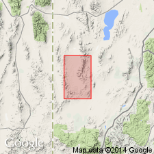
Raised in stratigraphic rank in Great Basin province from Wah Wah Springs Tuff Member of Needles Range Formation to Wah Wah Springs Formation of Needles Range Group (raised in rank). Divided into a lower outflow tuff member which covered an area of 22,000 sq km and had a volume of 1,500 cu km and an upper intra-caldera member which covered 1,200 sq km and a volume of 2,400 cu km. No single exposure shows both members together. The members are two cogenetic units related to evolution of the Indian Peak caldera. Recognized in southwest UT and east-central NV on areal extent map. At type locality of Wah Wah Springs in secs 21, 27, 28, T29S, R18W, only outflow member present. Another locality, secs 19-21, 27-30, T29S, R18W, Miners Cabin Wash and Buckhorn Spring 7 1/2 min quads, and secs 8-10, T30S, R18W, Atchison Creek and Pinto Springs quads designated type locality for intracaldera member. Is younger than Cottonwood Wash Tuff and older than Ryan Spring Formation (new). Has an average age of 29.5 m.y. by the K-Ar method. Is reversely magnetized. Derived from Indian Peak caldera. Assigned to the Oligocene.
Source: GNU records (USGS DDS-6; Denver GNULEX).

- Usage in publication:
-
- Wah Wah Springs Formation*
- Modifications:
-
- Mapped 1:24k
- Dominant lithology:
-
- Tuff
- AAPG geologic province:
-
- Great Basin province
Summary:
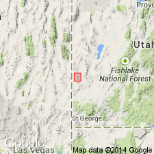
Is Oligocene formation mapped in southern part of Mountain Home Range in western Millard and Beaver Cos, southwest UT (Great Basin province) and with small outliers in eastern Lincoln Co, NV. Is third of four (ascending) formations of Needles Range Group (Oligocene) mapped in study area. Overlies Cottonwood Wash Tuff and is overlain by Lund Formation, both of Needles Range Group. Map unit described as ranging from porous, weakly welded, gray to light-brown tuff at top of unit, through compact, highly welded, slightly devitrified, red-brown tuff with eutaxitic white pumice lapilli and blocks near middle of unit, to a black, intensely welded vitrophyre 3-6 m thick near base of unit. Phenocrysts are plagioclase (25%), hornblende (9%), biotite (4%), quartz (2%), Fe-Ti oxides (1%), and green pyroxene (1%). Reversed magnetic polarity. Thickness uncertain due to extensive faulting, but exceeds 300 m.
Source: GNU records (USGS DDS-6; Denver GNULEX).
- Usage in publication:
-
- Wah Wah Springs Tuff*
- Modifications:
-
- Geochronologic dating
- Redescribed
- AAPG geologic province:
-
- Great Basin province
Summary:
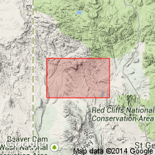
Mapped in southwest UT, Great Basin province. Redescribed as an olive-gray-weathering crystal-rich quartz latite ash-flow tuff with phenocrysts of plagioclase, biotite, hornblende, and minor quartz. Weathers to form slopes and yellowish or greenish soil. Unit is an important dating horizon as it provides oldest firm date in Tertiary sequence in Beaver Dam Mountains-Bull Valley-Iron Springs mining district area. K-Ar date on biotite of 29 Ma from sample in Maple Ridge quad (E.H. McKee, 1983, written comm.). Maximum thickness of 15 m is in northwest part of Motoqua quad, though is about 6 m thick in most places and is not present is some places suggesting it was deposited on an uneven surface of the underlying Claron Formation. Underlies pre-Isom Formation lacustrine rocks. Oligocene age.
Source: GNU records (USGS DDS-6; Denver GNULEX).
- Usage in publication:
-
- Wah Wah Springs Formation*
- Modifications:
-
- Geochronologic dating
- AAPG geologic province:
-
- Great Basin province
Summary:
A formation within Needles Range Group. Is one of largest and most widespread ash-flow sheets in the world. Derived from Indian Peak caldera complex which straddles NV-UT State line north of Modena, southwest UT, Great Basin province. Generally rests on Claron Formation but locally is interbedded with upper part of Claron; older than unnamed andesite. Composite stratigraphic column. Average K-Ar age is 29.5 Ma, but unpublished 40Ar/39Ar dates indicate that the current best estimate of its age is closer to 30 Ma (M.G. Best, 1993, written commun.). A new K-Ar date reported here on biotite from eastern Bull Valley Mountains is 29.5 +-0.9 Ma (Oligocene).
Source: GNU records (USGS DDS-6; Denver GNULEX).
For more information, please contact Nancy Stamm, Geologic Names Committee Secretary.
Asterisk (*) indicates published by U.S. Geological Survey authors.
"No current usage" (†) implies that a name has been abandoned or has fallen into disuse. Former usage and, if known, replacement name given in parentheses ( ).
Slash (/) indicates name conflicts with nomenclatural guidelines (CSN, 1933; ACSN, 1961, 1970; NACSN, 1983, 2005, 2021). May be explained within brackets ([ ]).