The National Geologic Map Database is migrating to a new infrastructure. We apologize for any service disruptions during this process.
|
|---|


- Usage in publication:
-
- Wabaunsee formation
- Modifications:
-
- Named
- Dominant lithology:
-
- Limestone
- Shale
- AAPG geologic province:
-
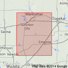
- Forest City basin
Summary:
Is named as formation consisting of massive limestone beds with interbedded calcareous, argillaceous, and arenaceous shale with occasional thin coal in Wabaunsee Co, KS (Forest City basin). "The formation covers one-half of Wabaunsee county and, on account of the excellent exposures along nearly every stream in the eastern and northern portions of the county, I would propose that it be called the Wabaunsee formation." Overlies the Osage coal horizon; underlies the basal massive limestone of the Cottonwood formation, known locally as the Cottonwood, Alma, and Manhattan limestones. Is 575+/-ft thick. Most of the formation (lower 525 ft) described as shales and marls interbedded with limestones, some of which form thick, massive strata; occasional thin coal in lower part. Upper part comprised of two units: "dry bone limestone," 10+/-ft, drab to bluish siliceous limestone that forms rough surface on weathering; overlain by 40 ft of shales. Upper part important because Swallow (1866) considered his bed No. 84 (named "dry bone limestone") the base of his Lower Permian, an interpretation not followed here. Entire formation is assigned to Upper Coal Measures series [Pennsylvanian] of Carboniferous period. Characteristic fossils listed. Includes rocks from top of Swallow's bed No. 154 to base of his bed No. 80. Is also compared with sections of Haworth and Kirk (1894).
Source: GNU records (USGS DDS-6; Denver GNULEX).

- Usage in publication:
-
- Wabaunsee formation
- Modifications:
-
- Revised
- AAPG geologic province:
-
- Forest City basin
Summary:
Pg. 59. Wabaunsee formation. The coal which Haworth and Prosser called the Osage is the Silver Lake coal, and the Topeka coal, 125 feet lower, is the Osage. Later the lower boundary of formation was placed higher, at base of Burlingame limestone, which is widely persistent and a good horizon marker. In Nebraska, includes (ascending) Burlingame limestone, Humphrey shale, Emporia limestone, Willard shale (true), Tarkio limestone, McKissick Grove shale, Admire shale, Americus limestone, Elmdale shale, Neva limestone, and Eskridge shale members. Present in eastern Kansas, northwestern Missouri, southeastern Nebraska, and southwestern Iowa. Thickness 400+ feet. Overlies Shawnee formation. Age is Late Pennsylvanian (Missouri age). Report includes cross sections, measured sections, geologic maps, stratigraphic tables.
Source: US geologic names lexicon (USGS Bull. 896, p. 2258-2259); GNC KS-NE Pennsylvanian Corr. Chart, sheet 1, Oct. 1936; supplemental information from GNU records (USGS DDS-6; Denver GNULEX).

- Usage in publication:
-
- Wabaunsee group*
- Modifications:
-
- Areal extent
- AAPG geologic province:
-
- Anadarko basin
Summary:
Extended as an undivided unit into the subsurface of Baca County, Colorado, in the Anadarko basin, east of the Las Animas arch. Consists of buff, fossiliferous, finely crystalline limestone, maroon and green shale, and some thin-bedded, brown to gray sandstone. Is 180 feet thick. Unconformably overlies Shawnee group (undivided) and unconformably underlies Admire shale. Age is Late Pennsylvanian (Virgilian). Report includes correlation chart.
Source: Modified from GNU records (USGS DDS-6; Denver GNULEX).

- Usage in publication:
-
- Wabaunsee group*
- Modifications:
-
- Revised
- AAPG geologic province:
-
- Nemaha anticline
- Forest City basin
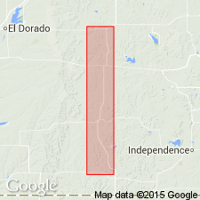
- Cherokee basin
Summary:
Pg. 2271-2278. Wabaunsee group. Redefined. Includes ascending [Severy shale, Howard limestone], Scranton shale, Bern limestone (new), Auburn shale, Emporia limestone, Willard shale, Zeandale limestone (new), Pillsbury shale (new), Stotler limestone (new), Root shale (new), and Wood Siding formation. Age is Late Pennsylvanian (Virgilian).
Source: US geologic names lexicon (USGS Bull. 1200, p. 4094-4096).
- Usage in publication:
-
- Wabaunsee Group
- Modifications:
-
- Revised
- AAPG geologic province:
-
- Cherokee basin
Summary:
In the southern part of Kansas, in the Cherokee basin, Howard Limestone of Wabaunsee Group revised to include two additional members, the Wauneta Limestone and [Shanghai Creek] Shale (both new); rocks were previously upper part of Aarde Shale. Age is Late Pennsylvanian (Virgilian). Report includes measured sections.
Source: Modified from GNU records (USGS DDS-6; Denver GNULEX).
For more information, please contact Nancy Stamm, Geologic Names Committee Secretary.
Asterisk (*) indicates published by U.S. Geological Survey authors.
"No current usage" (†) implies that a name has been abandoned or has fallen into disuse. Former usage and, if known, replacement name given in parentheses ( ).
Slash (/) indicates name conflicts with nomenclatural guidelines (CSN, 1933; ACSN, 1961, 1970; NACSN, 1983, 2005, 2021). May be explained within brackets ([ ]).