- Usage in publication:
-
- Wabash Formation
- Modifications:
-
- Named
- AAPG geologic province:
-
- Cincinnati arch
Summary:
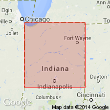
Pg. 34-47. Wabash Formation. Formation herein named for the body of rock in northern Indiana that extends southward from northern part of Fort Wayne Bank and that lies above Louisville Limestone and below Salina Formation. Where the Salina is absent and where the Wabash Formation is not at bedrock surface, it underlies rocks of Devonian System. In earlier reports, rocks referred here to Wabash Formation have been described as Wabash flaggings, reef rock, Huntington stone, shell rock, reefs, bioherms, quaquaversal structures, part of Niagara Group (line), Mississinewa Shale, Liston Creek Limestone, part of Huntington Dolomite, and part of New Croydon Limestone. Formations formerly called Mississinewa Shale and Liston Creek Limestone are herein accorded member status and assigned to Wabash Formation. Reefs, bioherms, banks, and upper Niagaran thick-bedded reef-detrital limestones and dolomites of northern Indiana that collectively have been called part of Huntington Dolomite are for most part facies of Mississinewa and Liston Creek Members of the Wabash. Term Huntington abandoned as stratigraphic term and Huntington Lithofacies proposed to replace it. Type area, five principal reference sections, and two reference sections designated. Term Wabash Formation proposed by Fuller and Clapp (1904, USGS Geol. Atlas of the US, Patoka folio, no. 105) for rocks of Pennsylvanian age has had little usage and is herein considered abandoned.
Type area: Upper Wabash Valley in Carroll, Cass, Miami, Wabash, and Huntington Cos.
Principal reference sections (all in IN):
(1) Northern Indiana Public Service Company Gale M. and Glada Skinner No. 1 well, in NW/4 NW/4 sec. 10, T. 28 N., R. 1 W., near Royal Denter, Cass Co.;
(2) Indiana Highway 13 roadcut south of Wabash and Wabash River, sec. N/2 J.B. Richardville Reserve No. 8 well, in T. 27 N., R. 6 E., Wabash Co.;
(3) Big Four Railroad cut in Wabash, Wabash Co.;
(4) Erie Stone Company, quarry just east of Huntington, in SE/4 sec. 12, T. 28 N., R. 9 E., Huntington Co.;
(5) May Stone and Sand, Inc., quarry southwest edge of Fort Wayne, in NW/4 sec. 29, T. 30 N., R. 12 E., Allen Co.
Source: US geologic names lexicon (USGS Bull. 1350, p. 800-801).
For more information, please contact Nancy Stamm, Geologic Names Committee Secretary.
Asterisk (*) indicates published by U.S. Geological Survey authors.
"No current usage" (†) implies that a name has been abandoned or has fallen into disuse. Former usage and, if known, replacement name given in parentheses ( ).
Slash (/) indicates name conflicts with nomenclatural guidelines (CSN, 1933; ACSN, 1961, 1970; NACSN, 1983, 2005, 2021). May be explained within brackets ([ ]).

