

- Usage in publication:
-
- Virginia slate*
- Modifications:
-
- Original reference
- Dominant lithology:
-
- Slate
- AAPG geologic province:
-
- Lake Superior region*
- Sioux uplift*
Summary:
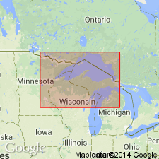
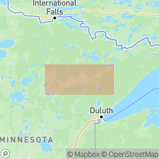
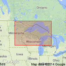
Pg. 353, 360. Virginia slate. Dense fine-grained gray or black slate. Called Virginia slate because in its typical form it has been found in numerous test pits and drill holes west of town of Virginia, St. Louis County, northeastern Minnesota. Top formation of Upper Huronian in Mesabi district. Unconformably underlies the great Keweenawan gabbro and conformably overlies iron-bearing Biwabik formation. Age is pre-Cambrian.
Source: U.S. geologic names lexicon (USGS Bull. 896, p. 2255).
- Usage in publication:
-
- Virginia slate*
- Modifications:
-
- Revised
- AAPG geologic province:
-
- Lake Superior region*
- Sioux uplift*
Summary:
Virginia slate. Stated that Virginia slate grades both vertically and horizontally into Biwabik formation; and C.R. Van Hise and C.K. Leith (1911) made same statement in USGS Monograph 52, p. 174. Age is pre-Cambrian.
Source: U.S. geologic names lexicon (USGS Bull. 896, p. 2255).
- Usage in publication:
-
- Virginia slate*
- Modifications:
-
- Age modified
- AAPG geologic province:
-
- Lake Superior region*
- Sioux uplift*
Summary:
(and USGS Monograph 52, 1911). Virginia slate. Treated Virginia slate as younger than Biwabik formation, but assigned both to upper Huronian.
Source: U.S. geologic names lexicon (USGS Bull. 896, p. 2255).
- Usage in publication:
-
- Virginia slate*
- Modifications:
-
- Revised
- AAPG geologic province:
-
- Lake Superior region*
- Sioux uplift*
Summary:
Virginia slate. Assigned Virginia slate to upper Huronian and Biwabik iron-formation to middle Huronian.
Source: U.S. geologic names lexicon (USGS Bull. 896, p. 2255).
- Usage in publication:
-
- Virginia slate*
- Modifications:
-
- Revised
- AAPG geologic province:
-
- Lake Superior region*
- Sioux uplift*
Summary:
Pg. 1021 (table 3), 1047-1050. Virginia slate. Included in Animikie group. Unit is an argillite and graywacke; lacks slaty cleavage and is not dynamically metamorphosed; much of it is thin bedded, but graywacke is thick bedded. Thickness estimated to be 2,000 to 3,000 feet in Cook County, Minnesota, but on western Mesabi may be much greater. Data on unit based largely on drill-core information. Overlies Biwabik iron-formation; contact may or may not be conformable. [Age is Precambrian.]
Source: U.S. geologic names lexicon (USGS Bull. 1200, p. 4089).
- Usage in publication:
-
- Virginia slate*
- Modifications:
-
- Revised
- AAPG geologic province:
-
- Lake Superior region*
- Sioux uplift*
Schwartz, G.M., 1951, Regional setting of the Cuyuna range: University of Minnesota, Center for Continuing Study, p. 1-3.
Summary:
Pg. 3. Virginia slate. For most part, the Deerwood iron formation and Cuyuna slates have been considered to belong to the Virginia. This correlation has very little evidence to support it. [Age is Precambrian.]
Source: U.S. geologic names lexicon (USGS Bull. 1200, p. 4089).
- Usage in publication:
-
- Virginia formation
- Modifications:
-
- Revised
- AAPG geologic province:
-
- Lake Superior region
- Sioux uplift
Grout, F.F., and Wolff, J.F., Sr., 1955, The geology of the Cuyuna district, Minnesota: Minnesota Geological Survey Bulletin, no. 36, 144 p., (incl. geologic maps)
Summary:
Pg. 3, 4, 7, 56, pl. 6. Virginia formation. In Cuyuna district, includes South Range iron-bearing member (new). [Age is Precambrian.]
Source: Publication; U.S. geologic names lexicon (USGS Bull. 1200, p. 4089).
- Usage in publication:
-
- Virginia Formation*
- Modifications:
-
- Reference
- Dominant lithology:
-
- Argillite
- Siltstone
- Graywacke
- AAPG geologic province:
-
- Lake Superior region
- Sioux uplift*
Lucente, M.E., and Morey, G.B., 1983, Stratigraphy and sedimentology of the Lower Proterozoic Virginia Formation, northern Minnesota: Minnesota Geological Survey Report of Investigations, no. 28, 20 p.
Summary:
Virginia Formation of Animikie Group. Argillite, siltstone, and graywacke. Uppermost formation of Animikie Group in Mesabi Range, northern Minnesota. Equivalent to Rabbit Lake Formation, uppermost formation of Animikie Group in Cuyuna Range, and Rove Formation, uppermost formation of Animikie Group in Gunflint Range. Surface exposures limited to where underlying Biwabik Iron-Formation is mined; underlies thick Quaternary deposits. In subsurface, divided into two informal, member-rank units: lower argillaceous lithosome, approx. 125 to 300 m-thick, dark-colored, fissile, carbonaceous argillite; and upper silty and sandy lithosome, approx. 300 m-thick, light-colored, intercalated siltstone and sandstone. Age is Early Proterozoic.
Two subsurface reference sections designated: (1) south of Biwabik in St. Louis Co.; and (2) south of Calumet in Itasca Co.
Drill core locations shown on geol. map (fig. 3). Authors state cores reposited at U.S. Bur. Mines Core Depository, Fort Snelling, MN.
Source: Publication.
For more information, please contact Nancy Stamm, Geologic Names Committee Secretary.
Asterisk (*) indicates published by U.S. Geological Survey authors.
"No current usage" (†) implies that a name has been abandoned or has fallen into disuse. Former usage and, if known, replacement name given in parentheses ( ).
Slash (/) indicates name conflicts with nomenclatural guidelines (CSN, 1933; ACSN, 1961, 1970; NACSN, 1983, 2005, 2021). May be explained within brackets ([ ]).