The National Geologic Map Database is migrating to a new infrastructure. We apologize for any service disruptions during this process.
|
|---|


- Usage in publication:
-
- Virgilina group
- Modifications:
-
- Areal extent
- AAPG geologic province:
-
- Piedmont-Blue Ridge province
Watson, T.L., 1916, Geologic map of Virginia: Virginia Geological Survey
Summary:
Virgilina group. Divided into 3 mapped units (descending): gabbro; quartz porphyry; and volcanic acid and basic tuffs. Overlies pre-Cambrian granite and granite gneiss.
Source: US geologic names lexicon (USGS Bull. 896, p. 2254-2255).
- Usage in publication:
-
- Virgilina greenstone
- Modifications:
-
- Principal reference
- Dominant lithology:
-
- Greenstone
- AAPG geologic province:
-
- Piedmont-Blue Ridge province
Summary:
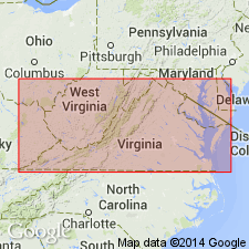
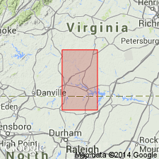
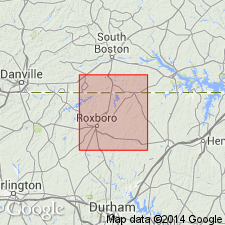
Pg. 15, 19, 27-34, and map. The basic volcanics, for which Virgilina greenstone is proposed, were originally andesite and andesitic tuffs but have become, through intense metamorphism, chlorite-epidote schists or simply greenstone schists. These for most part retain something of their original minerals. The rocks form Virgilina Ridge and are typically developed in and near town of Virgilina, [Virgilina district, Halifax County, central southern Virginia]. In present conditions the rock is a well-defined greenstone schist. [Mapped as Ordovician(?).]
Source: GNU records (USGS DDS-6; Reston GNULEX).
- Usage in publication:
-
- Virgilina Formation*
- Modifications:
-
- Areal extent
- Dominant lithology:
-
- Metavolcanics
- AAPG geologic province:
-
- Piedmont-Blue Ridge province
Summary:
Virgilina Formation used in accordance with Harris and Glover (1988). Consists of light-green, schistose metavolcanic rocks and minor amounts of metasandstone. Previously were basaltic to andesitic pyroclastic rocks, volcanic breccias, and sills interlayered with felsic pyroclastic rocks and silts. Volcanic rocks intergrade upward to laminated mudstone. Age is Late Proterozoic.
Source: GNU records (USGS DDS-6; Reston GNULEX).

- Usage in publication:
-
- Virgilina greenstone
- Modifications:
-
- Areal extent
- AAPG geologic province:
-
- Piedmont-Blue Ridge province
Summary:
Virgilina greenstone used on the State map in the sense of Laney (1917). Unit is grayish-green, fine- to coarse-grained basaltic pyroclastic tuff, metavolcanic breccia, and porphyritic to amygdaloidal greenstone, with minor interlayered metasedimentary rocks. Hydrothermal zones contain bornite, chalcocite, and chalcopyrite. Equivalent to the middle member of the Aaron Formation of Kreisa (1980) and the lower portion of the Virgilina Formation of Harris and Glover (1985). Age is Late Proterozoic. [No explanation for apparent informal usage.]
Source: GNU records (USGS DDS-6; Reston GNULEX).
For more information, please contact Nancy Stamm, Geologic Names Committee Secretary.
Asterisk (*) indicates published by U.S. Geological Survey authors.
"No current usage" (†) implies that a name has been abandoned or has fallen into disuse. Former usage and, if known, replacement name given in parentheses ( ).
Slash (/) indicates name conflicts with nomenclatural guidelines (CSN, 1933; ACSN, 1961, 1970; NACSN, 1983, 2005, 2021). May be explained within brackets ([ ]).