The National Geologic Map Database is migrating to a new infrastructure. We apologize for any service disruptions during this process.
|
|---|


- Usage in publication:
-
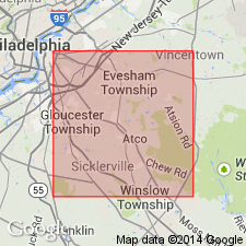
- Vincentown lime-sands*
- Modifications:
-
- Named
- Dominant lithology:
-
- Sand
- Greensand
- AAPG geologic province:
-
- Atlantic Coast basin
Summary:
Vincentown lime-sands are highly calcareous greensands, 20 to 100 ft thick, forming upper part of Rancocas formation [group]. Overlie Sewell [Hornerstown] marls. Named for Vincentown, Burlington Co., NJ. Age is early Eocene.
Source: GNU records (USGS DDS-6; Reston GNULEX).
- Usage in publication:
-
- Vincentown formation
- Modifications:
-
- Areal extent
- AAPG geologic province:
-
- Atlantic Coast basin
Summary:
Vincentown underlies Manasquan marl; overlies Hornerstown marl and occurs in belt immediately to southeast of it. Consists of calcareous phase and quartz phase with varying amounts of glauconite; the two phases are probably not traceable over great distances. Thickness at outcrop 25 to 100 ft; average dip 27 ft per mi. Opinion as to age is now divided between Paleocene (Midway) and lower Eocene (Wilcox); general opinion now favors Paleocene dating.
Source: GNU records (USGS DDS-6; Reston GNULEX).
- Usage in publication:
-
- Vincentown Formation
- Modifications:
-
- Areal extent
- AAPG geologic province:
-
- Atlantic Coast basin
Summary:
Unit occurs in an irregular, narrow belt that extends diagonally across NJ near the inner margin of the Coastal Plain through portions of Monmouth, Ocean, Burlington, Camden, Gloucester, and Salem Cos. Best outcrops are along Rancocas Creek, Shingle Run, and Big Timber Creek. Paleocene age of the formation is based mainly on foraminiferids and bryozoans. The Vincentown is exposed prominently in DE and is considered to be correlative with the Aquia Formation of MD. It is composed of two marine lithofacies: 1) a richly fossiliferous, calcareous limesand that contains occasional limestone layers, and 2) a quartz-sand facies that contains varying quantities of glauconite and relatively few fossils. Gradationally overlies the Hornerstown Formation and unconformably underlies the Manasquan Formation. Though 9 m thick at the type section, thickness increases downdip. Regional dip is 30 ft per mi. Width of outcrop belt is 5 to 6 mi in the southern NJ cos. Vincentown is one of the most fossiliferous units of the NJ Coastal Plain It is known primarily for its rich bryozoan and microfossil fauna. This report presents an updated list of macrofossil species.
Source: GNU records (USGS DDS-6; Reston GNULEX).
- Usage in publication:
-
- Vincentown Formation
- Modifications:
-
- Areal extent
- AAPG geologic province:
-
- Atlantic Coast basin
Summary:
Vincentown Formation of Rancocas Group is composed of several facies. Basal section contains glauconite in decreasing quantities. Quartz sand content gradually increases upward until glauconite becomes a minor constituent. The middle to upper part of the formation, especially in the northeastern portion of the outcrop belt, is dominantly a light-colored massive quartz sand. To the southwest, along strike, a third facies occurs. This is a yellowish gray clayey moderately to poorly sorted thin- to thick-bedded calcareous quartz sand to calcarenite, with glauconite as a minor constituent. Some limesands of this facies are largely composed of bryozoan fragments. Thickness ranges from 25 ft in the southwestern area to 100 ft in Monmouth Co. Fauna is abundant and varied. Unit extends from Monmouth Co. to the eastern shore of the Chesapeake Bay in MD. The quartz sand facies dominates in the northeast, while the glauconite sand facies dominates in the Delmarva Peninsula. The best outcrop is at the type locality in Burlington Co. but it is also exposed in the area of Big Timber Creek in Camden and Gloucester Cos. Age is Danian according to Gallagher (1984) and Thanetian according to Olsson (1970).
Source: GNU records (USGS DDS-6; Reston GNULEX).
- Usage in publication:
-
- Vincentown Formation*
- Modifications:
-
- Biostratigraphic dating
- AAPG geologic province:
-
- Atlantic Coast basin
Summary:
The Vincentown Formation in southwestern NJ is of late Paleocene age as represented by calcareous nannofossil zones NP 8 and NP 9. Unit underlies the Manasquan Formation. The Vincentown is equivalent to the Aquia Formation in VA and MD, and the Nanafalia Formation and most of the Tuscahoma Formation in AL.
Source: GNU records (USGS DDS-6; Reston GNULEX).
- Usage in publication:
-
- Vincentown Formation*
- Modifications:
-
- Biostratigraphic dating
- AAPG geologic province:
-
- Atlantic Coast basin
Summary:
Vincentown Formation in core K15, west of Clayton, NJ, correlates with calcareous nannofossil Zones NP 5, NP 7, NP 8, and NP 9. Core GL913, northwest of New Brooklyn, south-central NJ, shows Vincentown as correlating with Zones NP 5, NP 7, NP 8, and NP 9. Cores GL915 and GL917, northwest of New Brooklyn, shows Vincentown as correlating with Zones NP 5, NP 8, and NP 9. Core GL916, northwest of New Brooklyn, shows Vincentown as correlating with Zones NP 7 through NP 9. Core from Clayton, south-central NJ, shows Vincentown correlating with Zones NP 5, NP 8, and NP 9. In all cores, overlies Hornerstown Sand; in core K15, unconformably underlies early Miocene Kirkwood Formation; in all other cores, conformably underlies late Paleocene and early Eocene Manasquan Formation. Correlates with Aquia Formation of MD and VA, and with Nanafalia and Tuscahoma Formations of AL. Overall age is late Paleocene.
Source: GNU records (USGS DDS-6; Reston GNULEX).
For more information, please contact Nancy Stamm, Geologic Names Committee Secretary.
Asterisk (*) indicates published by U.S. Geological Survey authors.
"No current usage" (†) implies that a name has been abandoned or has fallen into disuse. Former usage and, if known, replacement name given in parentheses ( ).
Slash (/) indicates name conflicts with nomenclatural guidelines (CSN, 1933; ACSN, 1961, 1970; NACSN, 1983, 2005, 2021). May be explained within brackets ([ ]).