

- Usage in publication:
-
- View Formation
- Modifications:
-
- Named
- Dominant lithology:
-
- Schist
- Quartzite
- AAPG geologic province:
-
- Great Basin province
Summary:
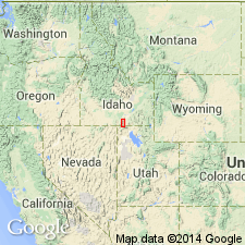
Named for the town of View, on the Snake River Plain, Cassia Co, ID in the Great Basin province, as one of eight formations of the Dove Creek Group (new). Type section designated in SW1/4 sec 34, T11S, R24E where the formation is about 1,200 ft thick, and consists of one-third calcareous schist and the rest is quartzite. The schist is a dark-colored graphitic, muscovite-quartz-calcite schist and dolomitic quartz schist. The quartzite is gray rusty-weathered with scattered conglomeratic layers. Geologic map; exposures limited; mapped in northern part of Albion Range. Overlies the newly named Cassia Dolomite (Ordovician, Silurian, Devonian) of the Dove Creek Group; the contact is a dolomite (Cassia) with dark schist (View). Is overlain by the Oquirrh? Formation (Pennsylvanian), uppermost formation of Dove Creek Group; upper contact placed at base of first limestone (Oquirrh?) above the quartzite (View). Of Mississippian? age.
Source: GNU records (USGS DDS-6; Denver GNULEX).
For more information, please contact Nancy Stamm, Geologic Names Committee Secretary.
Asterisk (*) indicates published by U.S. Geological Survey authors.
"No current usage" (†) implies that a name has been abandoned or has fallen into disuse. Former usage and, if known, replacement name given in parentheses ( ).
Slash (/) indicates name conflicts with nomenclatural guidelines (CSN, 1933; ACSN, 1961, 1970; NACSN, 1983, 2005, 2021). May be explained within brackets ([ ]).