The National Geologic Map Database is migrating to a new infrastructure. We apologize for any service disruptions during this process.
|
|---|


- Usage in publication:
-
- Verdi Member
- Modifications:
-
- Revised
- AAPG geologic province:
-
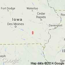
- Iowa shelf
Summary:
St. Louis Formation in southeast IA divided [by McKay] into the following members (ascending): Croton, Verdi, and Waugh (newly named). The Verdi was formerly referred to as the "upper" St. Louis by Van Tuyl (1922). Is well exposed at several localities in western Keokuk Co on the Iowa shelf. In Keokuk, Mahaska, and Marion Cos, averages 20 ft thick. Basal contact placed at top of massive sandstone of Croton or base of limestones of Verdi. Divided into a lower limestone interval of medium- to thick-bedded, bioturbated, peloidal and skeletal lime wackestone to packstone with diverse marine macro- and micro-fauna deposited during a shallowing-upward marine cycle, and an upper interbedded limestone and sandstone interval dominated by thin-bedded laminated pelletal lime mudstone to packstone grading up to brecciated lime mudstone and thin sandstone deposited in a shallow restricted marine and nearshore to shoreface environment. Large chert nodules and minor glauconite and quartz sand are scattered in the lower interval. Some sandstone in the upper interval can be massive, quartzose, friable, slightly calcareous, and cross-bedded. Overlain disconformably by planar to cross-stratified sandstones of Waugh. Sections described at Showman Station Quarry (p. 57, 58), Waugh Branch (p. 66-68). Cross sections. Fossils (brachiopods, conodonts, trilobites, ostracodes, fish teeth and scales) listed. Late Mississippian age.
Source: GNU records (USGS DDS-6; Denver GNULEX).
For more information, please contact Nancy Stamm, Geologic Names Committee Secretary.
Asterisk (*) indicates published by U.S. Geological Survey authors.
"No current usage" (†) implies that a name has been abandoned or has fallen into disuse. Former usage and, if known, replacement name given in parentheses ( ).
Slash (/) indicates name conflicts with nomenclatural guidelines (CSN, 1933; ACSN, 1961, 1970; NACSN, 1983, 2005, 2021). May be explained within brackets ([ ]).