

- Usage in publication:
-
- Verde formation
- Modifications:
-
- Overview
- AAPG geologic province:
-
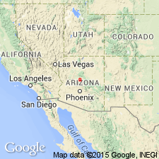
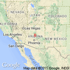
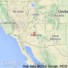
- Basin-and-Range province
Summary:
Pg. 3-26. Quaternary lake beds, 1,200+/- feet thick. Jenkins has recently studied and mapped the limestone deposits formed by this lake and named them Verde formation.
Source: US geologic names lexicon (USGS Bull. 896, p. 2239).
- Usage in publication:
-
- Verde formation*
- Modifications:
-
- Principal reference
- Dominant lithology:
-
- Limestone
- Sand
- Gravel
- Clay
- AAPG geologic province:
-
- Basin-and-Range province
Summary:
Pg. 65-81, map. Verde formation. Chiefly white hard impure reprecipitated cavernous limestone interbedded with sands, gravels, and clays and exposed in high white bluffs along the stream courses; generally horizontal and rather evenly bedded; near the border, or shore line, of old Verde Lake, conglomerate beds are in evidence, the boulders of which represent nearly all the rocks of surrounding country, including pieces of basalt. Thickness of formation 1,400 to 2,000 feet at least. Occurs along Verde River basin in region about Clarkdale and Camp Verde, Yavapai County, central Arizona. Overlies greatly eroded surface of various members of the Paleozoic and earlier rocks, and also some of basic lavas which occur in abundance in this region. The formation as a whole must not be confused with local spring deposits, although they have undoubtably aided in its limy accumulation and alteration. It is a local deposit, but similar local deposits, formed in a like manner, may be expected to occur in same general geologic or physiographic province. It covers an area of about 300 sq mi. No well-preserved fossils were found. Is unconformably overlain by terrace gravels which have generally been regarded as Pleistocene. The Verde formation may be late Tertiary [Pliocene] or Quaternary (very early Pleistocene).
Source: US geologic names lexicon (USGS Bull. 896, p. 2239).
- Usage in publication:
-
- Verde formation*
- Modifications:
-
- Areal extent
- AAPG geologic province:
-
- Basin-and-Range province
Summary:
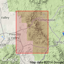
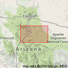
Pg. 59-61, fig. 2. Verde formation. Considered to be chiefly a lake deposit. Age shown on map as Pliocene(?) or Pleistocene. Unconformably overlies Hickey formation (new) in Jerome area, Yavapai County, central Arizona. Origin of name stated.
Named from occurrence in Verde Valley in region about Clarkdale and Camp Verde, Yavapai Co., central AZ. Partial measured section, 126.5 feet, in sec. 5, T. 15 N., R. 13 E.
Source: US geologic names lexicon (USGS Bull. 1200, p. 4067); supplemental information from GNU records (USGS DDS-6; Denver GNULEX).
- Usage in publication:
-
- Verde Formation*
- Modifications:
-
- Geochronologic dating
- Age modified
- AAPG geologic province:
-
- Basin-and-Range province
Summary:
Two samples of basalt (whole rock) from the Verde Formation yielded K-Ar ages of 5.5 +/-0.2 and 4.5 +/-0.2 Ma, indicating a Pliocene age. Verde mapped in the Mount Union, Mayer, Prescott, Mingus Mountain, Paulden, and Clarkdale quadrangles, Yavapai Co., central AZ.
Source: Modified from GNU records (USGS DDS-6; Denver GNULEX).
- Usage in publication:
-
- Verde Formation*
- Modifications:
-
- Mapped
- AAPG geologic province:
-
- Basin-and-Range province
Summary:
Verde formation. Lake deposits; subdivided into a limestone and clastic facies. Thickness 3,100+ feet. USGS adopts age of Miocene and Pliocene for Verde formation (based on Nations and others, 1981, Arizona Geol. Soc., Digest, v. 13, p. 133-149, review of paleontologic, isotopic, and magnetostratigraphic evidence).
Source: Publication; supplemental information from GNU records (USGS DDS-6; Denver GNULEX).
For more information, please contact Nancy Stamm, Geologic Names Committee Secretary.
Asterisk (*) indicates published by U.S. Geological Survey authors.
"No current usage" (†) implies that a name has been abandoned or has fallen into disuse. Former usage and, if known, replacement name given in parentheses ( ).
Slash (/) indicates name conflicts with nomenclatural guidelines (CSN, 1933; ACSN, 1961, 1970; NACSN, 1983, 2005, 2021). May be explained within brackets ([ ]).