- Usage in publication:
-
- Vanderlehr Formation*
- Modifications:
-
- Named
- Dominant lithology:
-
- Gneiss
- Schist
- Quartzite
- Conglomerate
- AAPG geologic province:
-
- Midcontinent region
Summary:
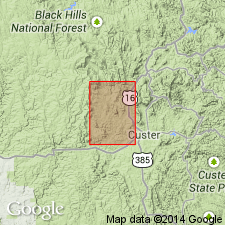
Named for Vanderlehr Creek. Type section extends along Vanderlehr Creek from a few hundred ft west of bench mark 5,821 to a point approximately 1,000 ft north of northwest corner sec 26, T2S, R3E, Berne quad, Pennington Co, SD in [Midcontinent region]. Extends north into Medicine Mountain quad, also in Pennington Co, and south into Custer Co in [Midcontinent region]. Has seven lithologies (listed in ascending order): 1) biotite-plagioclase gneiss; 2) quartzite, meta-arkose, and metaconglomerate; 3) calcite-tremolite gneiss; 4) quartz-mica garnet schist; 5) lower amphibolite schist; 6) mica and graphite schists; and 7) upper amphibole schist. Maximum exposed thickness is 2,000 ft. Believed to be the oldest of Precambrian rocks west of Grand Junction fault, and probably the oldest rocks in region. Loues Formation (new name) shown as next younger formation.
Source: GNU records (USGS DDS-6; Denver GNULEX).

- Usage in publication:
-
- Vanderlehr Formation*
- Modifications:
-
- Age modified
- AAPG geologic province:
-
- Midcontinent region
Summary:
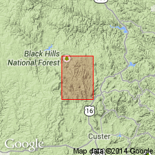
Mapped with Early Proterozoic units Xb and Xc (Pl. 1) in the Medicine Mountain area, Berne quad, Custer Co, SD in the Midcontinent region. Geologic map.
Source: GNU records (USGS DDS-6; Denver GNULEX).

- Usage in publication:
-
- Vanderlehr Formation*
- Modifications:
-
- Revised
- AAPG geologic province:
-
- Midcontinent region
Summary:
The basal unit, a biotite-plagioclase gneiss about 200 ft thick, formerly assigned to the Vanderlehr in the Berne quad to the south, is removed from the formation in the Medicine Mountain quad, Pennington Co, SD in the Midcontinent region. The gneiss is unnamed, considered to be Archean age, and is oldest unit in the quad. The gneiss was intruded by the granite at Bear Mountain, which has an isochron age of 2,415 +/-65 m.y. Is older than Oreville Formation. Nature of Oreville-Vanderlehr contact uncertain--it could be gradational; it could be a fault or unconformity. Was deposited in a shelf and marine environment possibly as part of an island arc. Assigned to the Early? Proterozoic.
Source: GNU records (USGS DDS-6; Denver GNULEX).
For more information, please contact Nancy Stamm, Geologic Names Committee Secretary.
Asterisk (*) indicates published by U.S. Geological Survey authors.
"No current usage" (†) implies that a name has been abandoned or has fallen into disuse. Former usage and, if known, replacement name given in parentheses ( ).
Slash (/) indicates name conflicts with nomenclatural guidelines (CSN, 1933; ACSN, 1961, 1970; NACSN, 1983, 2005, 2021). May be explained within brackets ([ ]).

