

- Usage in publication:
-
- Van Buskirk Gneiss*
- Modifications:
-
- Original reference
- Dominant lithology:
-
- Gneiss
- AAPG geologic province:
-
- Lake Superior region
Summary:
Pg. 14-26, pl. 1 (geol. map). Van Buskirk Gneiss. A migmatitic, crudely to sharply layered gneiss consisting of alternation of strongly foliated biotitic quartz diorite and equigranular to porphyritic quartz monzonite. Gradational into the Puritan Quartz Monzonite within the Puritan-Van Buskirk pluton. Age is early Precambrian (Precambrian W); [late Archean].
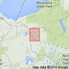
[Type locality]: exposures in parts of secs. 12 and 13, T. 46 N., R. 47 W., [Ironwood and Bessemer 7.5-min quadrangles], Gogebic Co., Northern Peninsula, western MI, close to community of Van Buskirk [in Ironwood 7.5-min quadrangle, Iron Co., eastern WI].
Source: Publication; US geologic names lexicon (USGS Bull. 1564, p. 179); ; Changes in stratigraphic nomenclature, 1976 (USGS Bull. 1435-A, p. A109).
For more information, please contact Nancy Stamm, Geologic Names Committee Secretary.
Asterisk (*) indicates published by U.S. Geological Survey authors.
"No current usage" (†) implies that a name has been abandoned or has fallen into disuse. Former usage and, if known, replacement name given in parentheses ( ).
Slash (/) indicates name conflicts with nomenclatural guidelines (CSN, 1933; ACSN, 1961, 1970; NACSN, 1983, 2005, 2021). May be explained within brackets ([ ]).